alb3924201
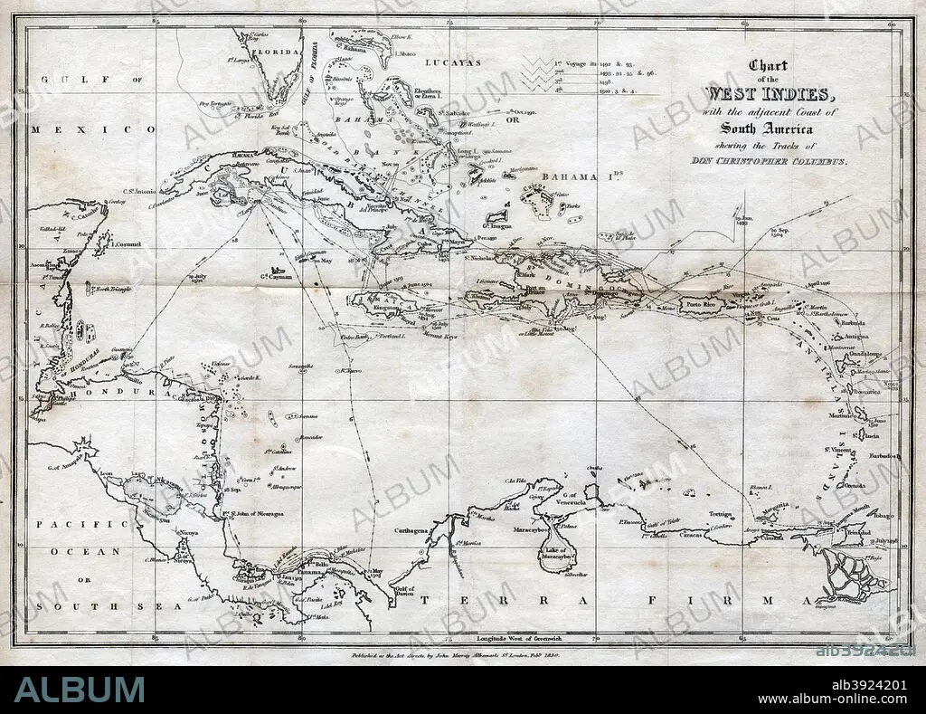
Chart of the West Indies, with the adjacent Coast of South America, 1830. Artist: J&C Walker
| Teilen |
|---|
 Pinterest Pinterest |
 Twitter Twitter |
 Facebook Facebook |
 Link kopieren Link kopieren |
 Email Email |
|
Zu einem anderen Lightbox hinzufügen |
|
Zu einem anderen Lightbox hinzufügen |


Haben Sie bereits ein Konto? Anmelden
Sie haben kein Konto? Registrieren
Dieses Bild kaufen.
Nutzung auswählen:

Titel:
Chart of the West Indies, with the adjacent Coast of South America, 1830. Artist: J&C Walker
Untertitel:
Siehe automatische Übersetzung
Chart of the West Indies, with the adjacent Coast of South America, 1830. Map of the Caribbean, showing the tracks of Christopher Columbus.
Bildnachweis:
Album / The Print Collector / Heritage Images
Freigaben (Releases):
Bildgröße:
4940 x 3549 px | 50.2 MB
Druckgröße:
41.8 x 30.0 cm | 16.5 x 11.8 in (300 dpi)
Schlüsselwörter:
15. JAHRHUNDERT • 15. JH. • 16. JAHRHUNDERT • 16. JH. • ENTDECKER • ENTDECKUNG • ERKUNDUNG • FORSCHER • GEOGRAFIE • GEOGRAPHIE • ITALIEN • KARIBIK • KARTHOGRAFIE • KARTOGRAFIE (KARTE) • KARTOGRAPHIE • MONOCHROM • MONOCHROMIE • REISE • REISENDER • SCHWARZ UND WEISS • SCHWARZ-WEIß • SCHWARZWEISS • SPANIEN • SUEDAMERIKA • SÜDAMERIKA • WALZ • WISSENSCH.: KARTOGRAPHIE • WISSENSCHAFT: ENTDECKER • WISSENSCHAFT: FORSCHER
