alb4094495
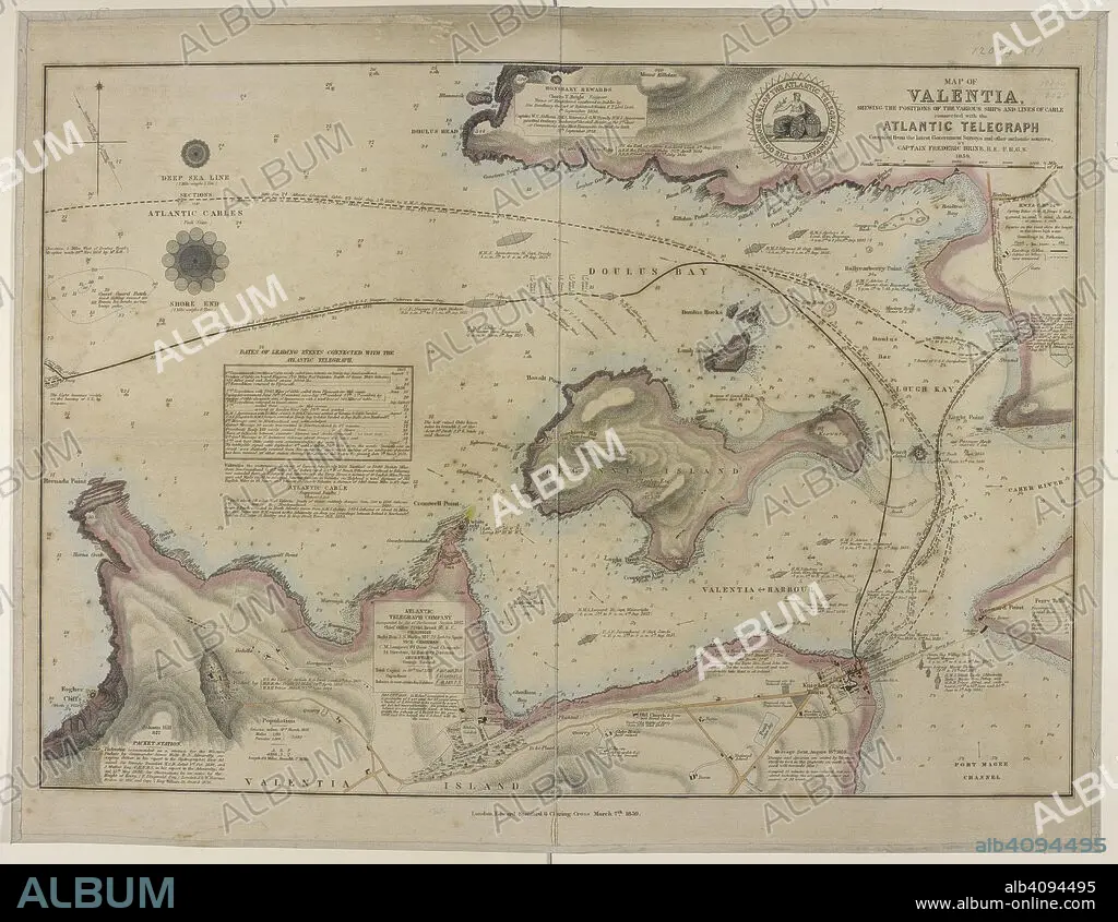
FREDERIC BRINE. Map showing a coast of Valentia island and the harbour; Doulus bay; and the lines of cables connected with the Atlantic telegraph. Map of Valentia shewing the positions of the various Ships and Lines of Cable connected with the Atlantic Telegraph. Compiled ... by Captain F. Brine. London : E. Stanford, 1859. Source: Maps.12094.(1).
| Teilen |
|---|
 Pinterest Pinterest |
 Twitter Twitter |
 Facebook Facebook |
 Link kopieren Link kopieren |
 Email Email |
|
Zu einem anderen Lightbox hinzufügen |
|
Zu einem anderen Lightbox hinzufügen |


Haben Sie bereits ein Konto? Anmelden
Sie haben kein Konto? Registrieren
Dieses Bild kaufen.
Nutzung auswählen:

Autor:
Untertitel:
Siehe automatische Übersetzung
Map showing a coast of Valentia island and the harbour; Doulus bay; and the lines of cables connected with the Atlantic telegraph. Map of Valentia shewing the positions of the various Ships and Lines of Cable connected with the Atlantic Telegraph. Compiled ... by Captain F. Brine. London : E. Stanford, 1859. Source: Maps.12094.(1).
Bildnachweis:
Album / British Library
Freigaben (Releases):
Model: Nein - Eigentum: Nein
Rechtefragen?
Rechtefragen?
Bildgröße:
5760 x 4456 px | 73.4 MB
Druckgröße:
48.8 x 37.7 cm | 19.2 x 14.9 in (300 dpi)
Schlüsselwörter:
