alb4460817
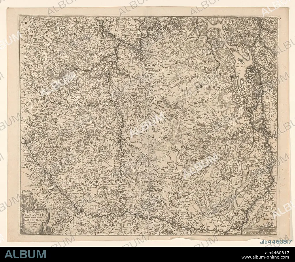
Map of the Duchy of Brabant, Tabula ducatus Brabantiae continens marchionatum sacri imperii and dominium Mechliniense (title on object), Map of Brabant. The north top right, compass rose in the middle. Bottom left cartouche with title, coat of arms, weapons, draperies and putto. Bottom right scale in German miles and Urengaans 'controlling 3 German Miles', maps of separate countries or regions, Brabant, Frederik de Wit, Amsterdam, 1666, paper, engraving, h 49.5 cm × w 54.7 cm.
| Teilen |
|---|
 Pinterest Pinterest |
 Twitter Twitter |
 Facebook Facebook |
 Link kopieren Link kopieren |
 Email Email |
|
Zu einem anderen Lightbox hinzufügen |
|
Zu einem anderen Lightbox hinzufügen |


Haben Sie bereits ein Konto? Anmelden
Sie haben kein Konto? Registrieren
Dieses Bild kaufen.
Nutzung auswählen:

Untertitel: Siehe automatische Übersetzung
Map of the Duchy of Brabant, Tabula ducatus Brabantiae continens marchionatum sacri imperii and dominium Mechliniense (title on object), Map of Brabant. The north top right, compass rose in the middle. Bottom left cartouche with title, coat of arms, weapons, draperies and putto. Bottom right scale in German miles and Urengaans 'controlling 3 German Miles', maps of separate countries or regions, Brabant, Frederik de Wit, Amsterdam, 1666, paper, engraving, h 49.5 cm × w 54.7 cm
Map of the Duchy of Brabant, Tabula ducatus Brabantiae continens marchionatum sacri imperii and dominium Mechliniense (title on object), Map of Brabant. The north top right, compass rose in the middle. Bottom left cartouche with title, coat of arms, weapons, draperies and putto. Bottom right scale in German miles and Urengaans 'controlling 3 German Miles', maps of separate countries or regions, Brabant, Frederik de Wit, Amsterdam, 1666, paper, engraving, h 49.5 cm × w 54.7 cm
Bildnachweis: Album / quintlox
Freigaben (Releases): ? Modellfreigabe: Nein - ? Eigentumsfreigabe: Nein
Rechtefragen?
Rechtefragen?
Bildgröße: 5860 × 4903 px | 82.2 MB
Druckgröße: 49.6 × 41.5 cm | 2307.1 × 1930.3 in (300 dpi)
Schlüsselwörter: AMSTERDAM • GRAVUR • KARTE (KARTHOGRAFIE) • KARTEN • KARTHOGRAPHIE • LANDKARTE • MANTEL • OBJEKT • PALETOT • PAPIER • PLAN (KARTOGRAPHIE) • PUTTE • REGIONEN • STICH (KUNST) • WAFFE • WAFFEN
