alb2203328
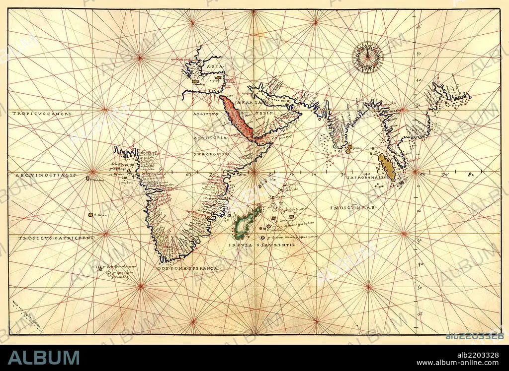
Portolan Map of Africa, the Indian Ocean and the Indian Subcontinent 1544
| Teilen |
|---|
 Pinterest Pinterest |
 Twitter Twitter |
 Facebook Facebook |
 Link kopieren Link kopieren |
 Email Email |
|
Zu einem anderen Lightbox hinzufügen |
|
Zu einem anderen Lightbox hinzufügen |


Haben Sie bereits ein Konto? Anmelden
Sie haben kein Konto? Registrieren
Dieses Bild kaufen

Titel:
Portolan Map of Africa, the Indian Ocean and the Indian Subcontinent 1544
Untertitel:
Siehe automatische Übersetzung
Portolan Map of Africa, the Indian Ocean and the Indian Subcontinent. Done in 1544 by the Italian cartographer Battista Agnese.
Bildnachweis:
Album / Universal Images Group / Universal History Archive/UIG
Freigaben (Releases):
Model: Nein - Eigentum: Nein
Rechtefragen?
Rechtefragen?
Bildgröße:
5083 x 3450 px | 50.2 MB
Druckgröße:
43.0 x 29.2 cm | 16.9 x 11.5 in (300 dpi)
Schlüsselwörter:
