alb5371389
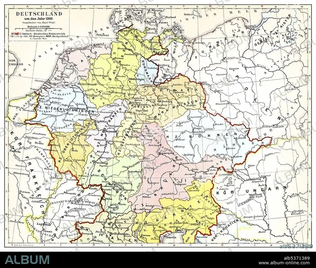
Historical map of Germany and Europe, Roman-German Empire in the 10th Century, from Meyers Konversations-Lexikon encyclopaedia, 1890
| Teilen |
|---|
 Pinterest Pinterest |
 Twitter Twitter |
 Facebook Facebook |
 Link kopieren Link kopieren |
 Email Email |
|
Zu einem anderen Lightbox hinzufügen |
|
Zu einem anderen Lightbox hinzufügen |


Haben Sie bereits ein Konto? Anmelden
Sie haben kein Konto? Registrieren
Dieses Bild kaufen.
Nutzung auswählen:

Untertitel: Siehe automatische Übersetzung
Historical map of Germany and Europe, Roman-German Empire in the 10th Century, from Meyers Konversations-Lexikon encyclopaedia, 1890
Historical map of Germany and Europe, Roman-German Empire in the 10th Century, from Meyers Konversations-Lexikon encyclopaedia, 1890
Bildnachweis: Album / ImageBroker / H.-D. Falkenstein
Freigaben (Releases): ? Modellfreigabe: Nein - ? Eigentumsfreigabe: Nein
Rechtefragen?
Rechtefragen?
Bildgröße: 4699 × 3746 px | 50.4 MB
Druckgröße: 39.8 × 31.7 cm | 1850.0 × 1474.8 in (300 dpi)
Schlüsselwörter: BILDER • DEUTSCH • FARBIG • GEOGRAFIE • GEOGRAPHIE • ILLUSTRATION • ILLUSTRATIONS • IN GEMAELDEN • INNENRAEUME: IN GEMAELDEN • KADER • KARTE • KARTEN • MALEN • MEHRFARBIG • PAPPE • ZEICHNUNGEN
