alb3791449
Topographical Map of Coordinates 45 N, 90 W
| Teilen |
|---|
 Pinterest Pinterest |
 Twitter Twitter |
 Facebook Facebook |
 Link kopieren Link kopieren |
 Email Email |
|
Zu einem anderen Lightbox hinzufügen |
|
Zu einem anderen Lightbox hinzufügen |


Haben Sie bereits ein Konto? Anmelden
Sie haben kein Konto? Registrieren
Dieses Bild kaufen.
Nutzung auswählen:

Titel:
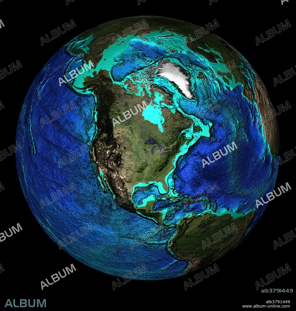
Topographical Map of Coordinates 45 N, 90 W
Untertitel:
Siehe automatische Übersetzung
Topographical map of the Earth, centered on 45 degrees North, 90 degrees West. Visible are the mid- Atlantic Ridge in the Atlantic Ocean (at right), and Pacific Coast Ranges of western North America (dark brown area), notably the Rocky Mountains. The seas and oceans are color-coded by depth and land colors are based on MODIS true-color data from the Terra satellite in 2004 where darker regions represent highlands. Turquoise regions represent the continental shelf and descend to around 150 meters before dropping off abruptly at the shelf break. The descent of the continental slope to the ocean floor is shown as increasingly dark shades of blue.
Bildnachweis:
Album / NOAA/Science Source
Freigaben (Releases):
Bildgröße:
2400 x 2400 px | 16.5 MB
Druckgröße:
20.3 x 20.3 cm | 8.0 x 8.0 in (300 dpi)
Schlüsselwörter:
AMERIKA • AMERIKA, KONTINENT • ATLANTIK • ATLANTISCHER OZEAN • GEOGRAFIE • GEOGRAPHIE • GLOBUS • KARTHOGRAFIE • KARTOGRAFIE (KARTE) • KARTOGRAPHIE • KONTINENT: AMERIKA • MEER • MEERE • OZEAN • OZEANOGRAPHIE • PAZIFIK • PAZIFISCHR OZEAN • PLANET ALLE • PLANET • SEA • SEESTUECK (GEMAELDE) • SUEDAMERIKA • SÜDAMERIKA • TERRA • TOPOGRAPHIE • WELTKUGEL • WISSENSCH.: KARTOGRAPHIE
