alb8372440
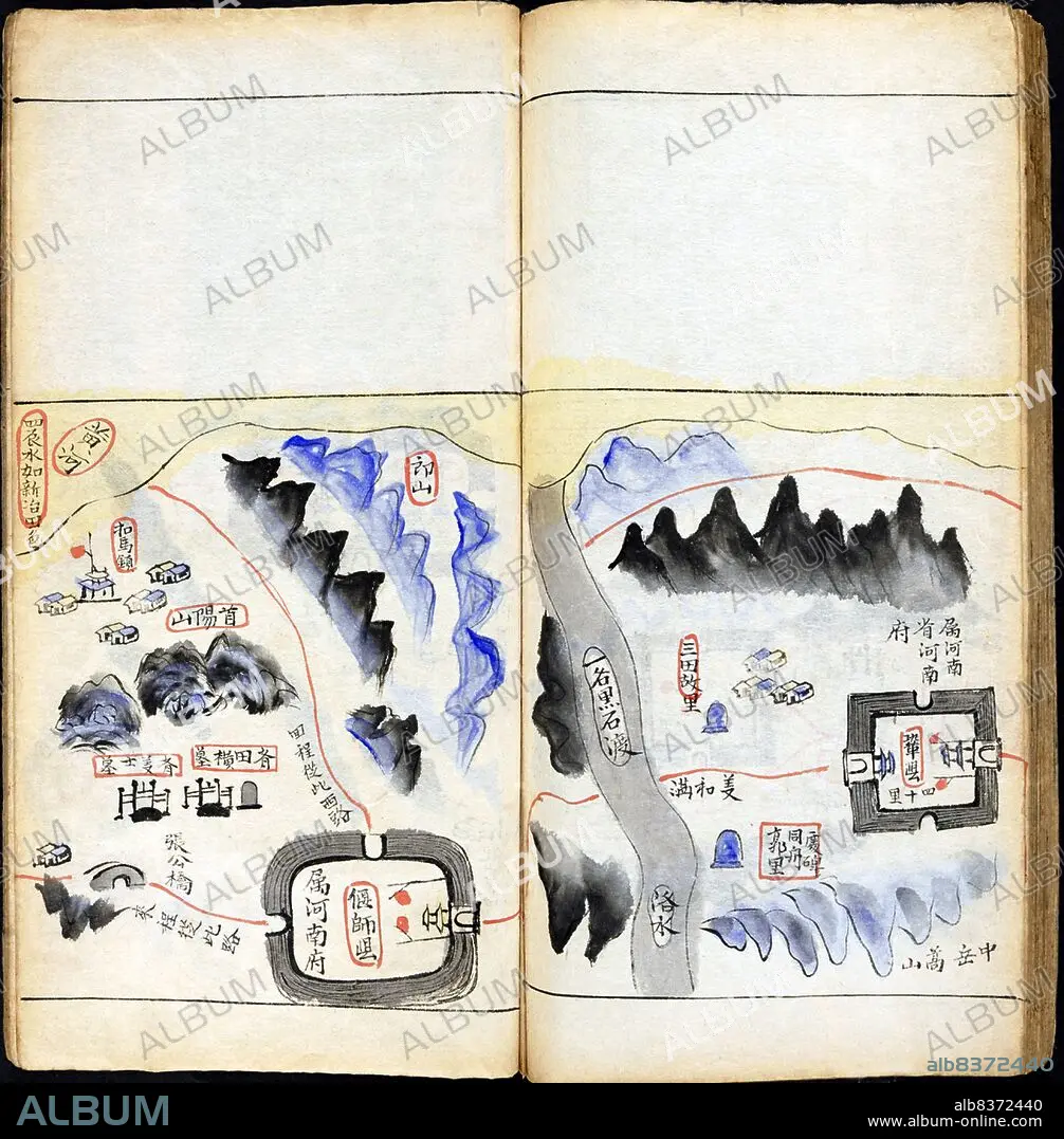
Vietnam / China: A Vietnamese map of Gong Xian County and the Luo River, Henan Province. From Bac Su Thuy Luc Dia Do< / i>, The northwards embassy by land and water from Hanoi to Beijing, Hanoi,1880
| Teilen |
|---|
 Pinterest Pinterest |
 Twitter Twitter |
 Facebook Facebook |
 Link kopieren Link kopieren |
 Email Email |
|
Zu einem anderen Lightbox hinzufügen |
|
Zu einem anderen Lightbox hinzufügen |


Haben Sie bereits ein Konto? Anmelden
Sie haben kein Konto? Registrieren
Dieses Bild kaufen

Titel:
Vietnam / China: A Vietnamese map of Gong Xian County and the Luo River, Henan Province. From Bac Su Thuy Luc Dia Do< / i>, The northwards embassy by land and water from Hanoi to Beijing, Hanoi,1880
Untertitel:
Siehe automatische Übersetzung
Written in the Vietnamese language in Chinese characters (chu han) and dated 1880, this manuscript is a complete visual record of the route from Bac Thanh (the name of Hanoi under the Nguyen Dynasty) through China to Beijing, taken by envoys of the Vietnamese Emperor Tu Duc (r.1847-1883) on their tribute-bearing mission in 1880.
. This work was created as an archival record of the journey. Roads, mountains, waterways, bridges, buildings, cities and towns are all clearly depicted, as are the points of departure and arrival on the first and last pages. The title, written in Chinese characters (Beishi shuilu dituchu), also includes the date (gengchen) of the journey, according to the Chinese 60-year cyclical system.
. The annotations on each page list place names and distances in Chinese miles (li or ly in Vietnamese) with occasional useful notes, such as from here merchants used only Qianlong money. Land routes are marked in red ink and water routes are recorded in blue ink.
Bildnachweis:
Album / Universal Images Group / Pictures From History
Freigaben (Releases):
Model: Nein - Eigentum: Nein
Rechtefragen?
Rechtefragen?
Bildgröße:
4378 x 4456 px | 55.8 MB
Druckgröße:
37.1 x 37.7 cm | 14.6 x 14.9 in (300 dpi)
Schlüsselwörter:
