alb9378341
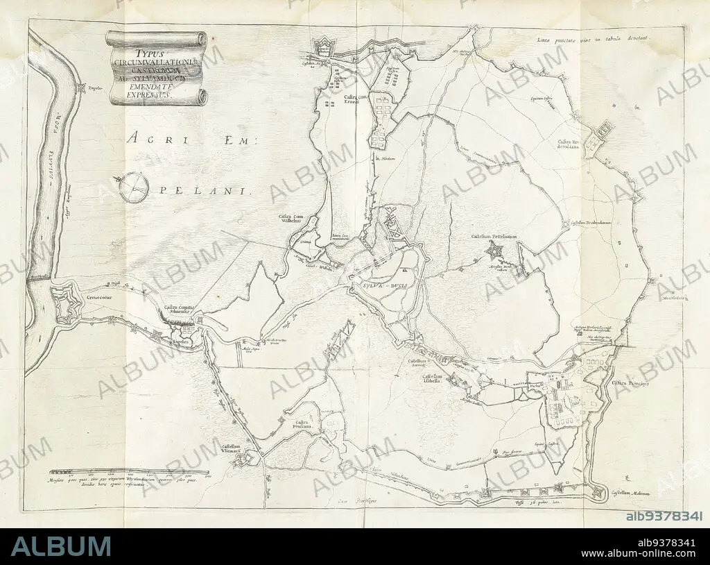
Encirclement of Den Bosch during the siege by Frederick Henry, 1629, Typus circumvallationis castrorum ad Sylvamducis, emendate expressus (title on object), Map of the encirclement of Den Bosch during the siege by the State army under Frederick Henry, from May 1 to September 17, 1629. On the left the fort Crèvecoeur on the Maas. Inscriptions in the representation in Latin., print maker: anonymous, Staten-Generaal, Northern Netherlands, 1629 - 1631, paper, etching, height 360 mm × width 493 mm.
| Teilen |
|---|
 Pinterest Pinterest |
 Twitter Twitter |
 Facebook Facebook |
 Link kopieren Link kopieren |
 Email Email |
|
Zu einem anderen Lightbox hinzufügen |
|
Zu einem anderen Lightbox hinzufügen |


Haben Sie bereits ein Konto? Anmelden
Sie haben kein Konto? Registrieren
Dieses Bild kaufen.
Nutzung auswählen:

Untertitel:
Siehe automatische Übersetzung
Encirclement of Den Bosch during the siege by Frederick Henry, 1629, Typus circumvallationis castrorum ad Sylvamducis, emendate expressus (title on object), Map of the encirclement of Den Bosch during the siege by the State army under Frederick Henry, from May 1 to September 17, 1629. On the left the fort Crèvecoeur on the Maas. Inscriptions in the representation in Latin., print maker: anonymous, Staten-Generaal, Northern Netherlands, 1629 - 1631, paper, etching, height 360 mm × width 493 mm
Bildnachweis:
Album / quintlox
Freigaben (Releases):
Model: Nein - Eigentum: Nein
Rechtefragen?
Rechtefragen?
Bildgröße:
5544 x 4122 px | 65.4 MB
Druckgröße:
46.9 x 34.9 cm | 18.5 x 13.7 in (300 dpi)
Schlüsselwörter:
