alb1962708
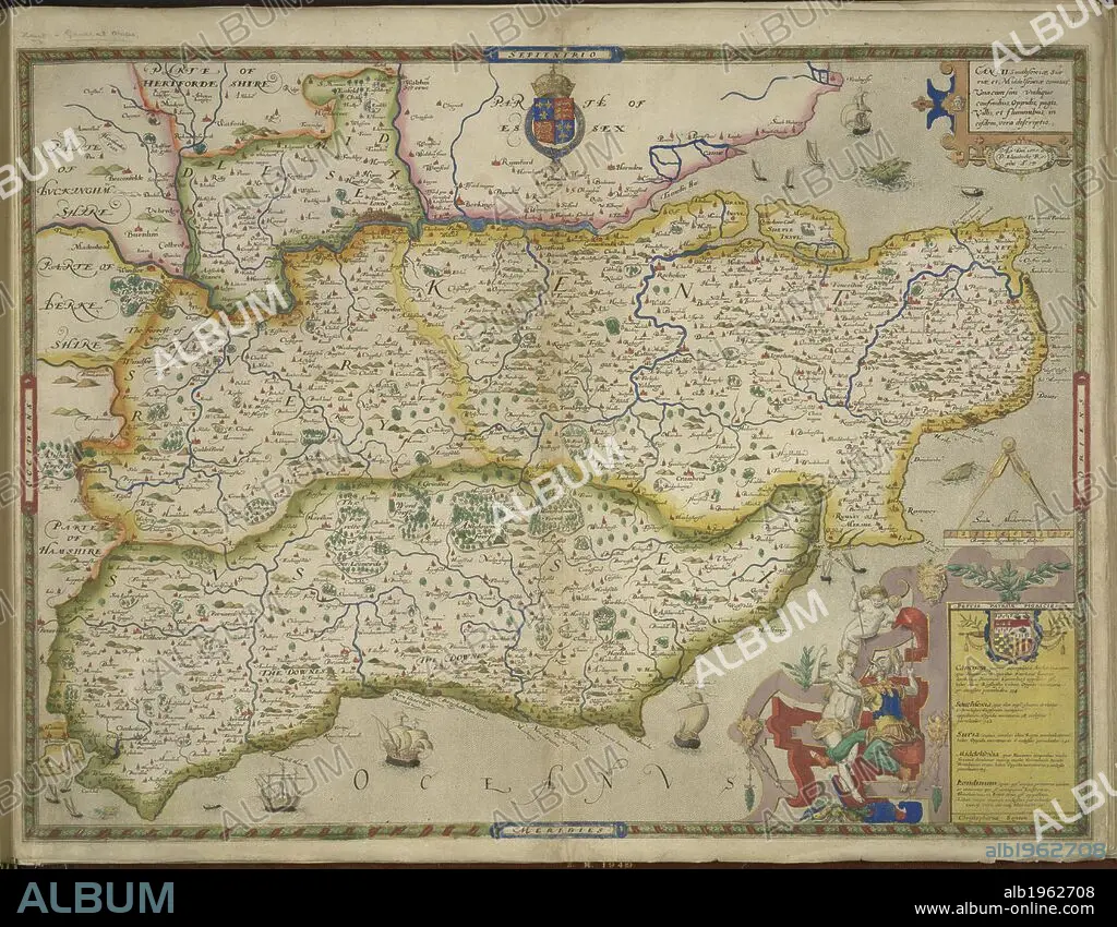
Sussex and Kent. An atlas of England and Wales, containing 35 colou. London, 1579. A map of Sussex and Kent, with parts of Essex, Buckinghamshire, Bekshire, Hampshire and Middlesex. Image taken from An atlas of England and Wales, containing 35 coloured maps, drawn by Christopher Saxton and engraved by A. Ryther, R. Hogenberg, C. Hogius, N. Reynolds, L. Terwoort and F. Scatter. Originally published/produced in 1579. Source: Maps.C.3.bb.5, f.11. Language: English.
| Teilen |
|---|
 Pinterest Pinterest |
 Twitter Twitter |
 Facebook Facebook |
 Link kopieren Link kopieren |
 Email Email |
|
Zu einem anderen Lightbox hinzufügen |
|
Zu einem anderen Lightbox hinzufügen |


Haben Sie bereits ein Konto? Anmelden
Sie haben kein Konto? Registrieren
Dieses Bild kaufen.
Nutzung auswählen:

Untertitel:
Siehe automatische Übersetzung
Sussex and Kent. An atlas of England and Wales, containing 35 colou. London, 1579. A map of Sussex and Kent, with parts of Essex, Buckinghamshire, Bekshire, Hampshire and Middlesex. Image taken from An atlas of England and Wales, containing 35 coloured maps, drawn by Christopher Saxton and engraved by A. Ryther, R. Hogenberg, C. Hogius, N. Reynolds, L. Terwoort and F. Scatter. Originally published/produced in 1579. Source: Maps.C.3.bb.5, f.11. Language: English.
Bildnachweis:
Album / British Library
Freigaben (Releases):
Model: Nein - Eigentum: Nein
Rechtefragen?
Rechtefragen?
Bildgröße:
5784 x 4503 px | 74.5 MB
Druckgröße:
49.0 x 38.1 cm | 19.3 x 15.0 in (300 dpi)
Schlüsselwörter:
