alb1963444
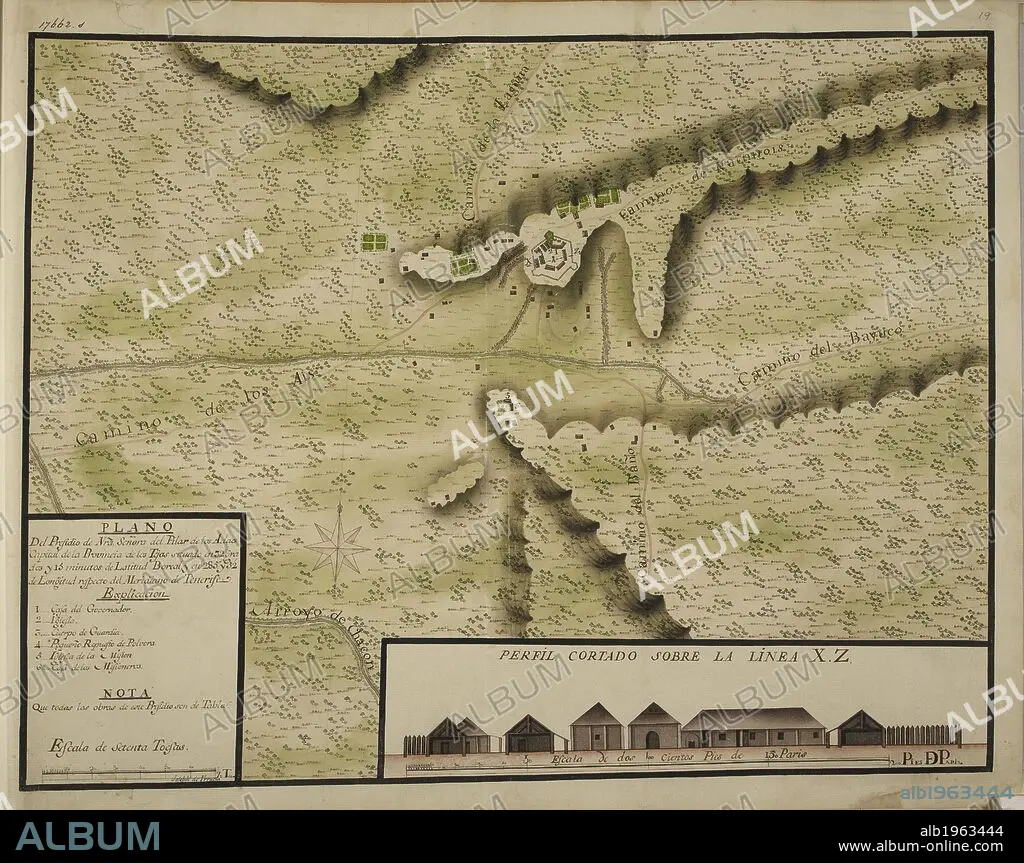
"Plano del Presidio de Nuestra Señora del Pilar de los Adaes, capital de la provincia de los Tejas, situado en 32º y 15ʹ de latitud boreal;" drawn by Joseph de Vrrutia, on a scale of 48 toises to an inch; with a profile on a scale of 18 Paris feet to an inch. . TWENTY-ONE coloured maps and plans of towns and various settlements in the North of Mexico with their environs; all, except one, situated in the Provincias Internas. By Joseph de Urrutia. Paper, XVIIIth cent. Folio. Ca. 1768. Source: Add. 17662 s19.
| Teilen |
|---|
 Pinterest Pinterest |
 Twitter Twitter |
 Facebook Facebook |
 Link kopieren Link kopieren |
 Email Email |
|
Zu einem anderen Lightbox hinzufügen |
|
Zu einem anderen Lightbox hinzufügen |


Haben Sie bereits ein Konto? Anmelden
Sie haben kein Konto? Registrieren
Dieses Bild kaufen

Autor:
Untertitel:
Siehe automatische Übersetzung
"Plano del Presidio de Nuestra Señora del Pilar de los Adaes, capital de la provincia de los Tejas, situado en 32º y 15ʹ de latitud boreal;" drawn by Joseph de Vrrutia, on a scale of 48 toises to an inch; with a profile on a scale of 18 Paris feet to an inch. . TWENTY-ONE coloured maps and plans of towns and various settlements in the North of Mexico with their environs; all, except one, situated in the Provincias Internas. By Joseph de Urrutia. Paper, XVIIIth cent. Folio. Ca. 1768. Source: Add. 17662 s19.
Bildnachweis:
Album / British Library
Freigaben (Releases):
Model: Nein - Eigentum: Nein
Rechtefragen?
Rechtefragen?
Bildgröße:
6410 x 5068 px | 92.9 MB
Druckgröße:
54.3 x 42.9 cm | 21.4 x 16.9 in (300 dpi)
Schlüsselwörter:
