alb9409488
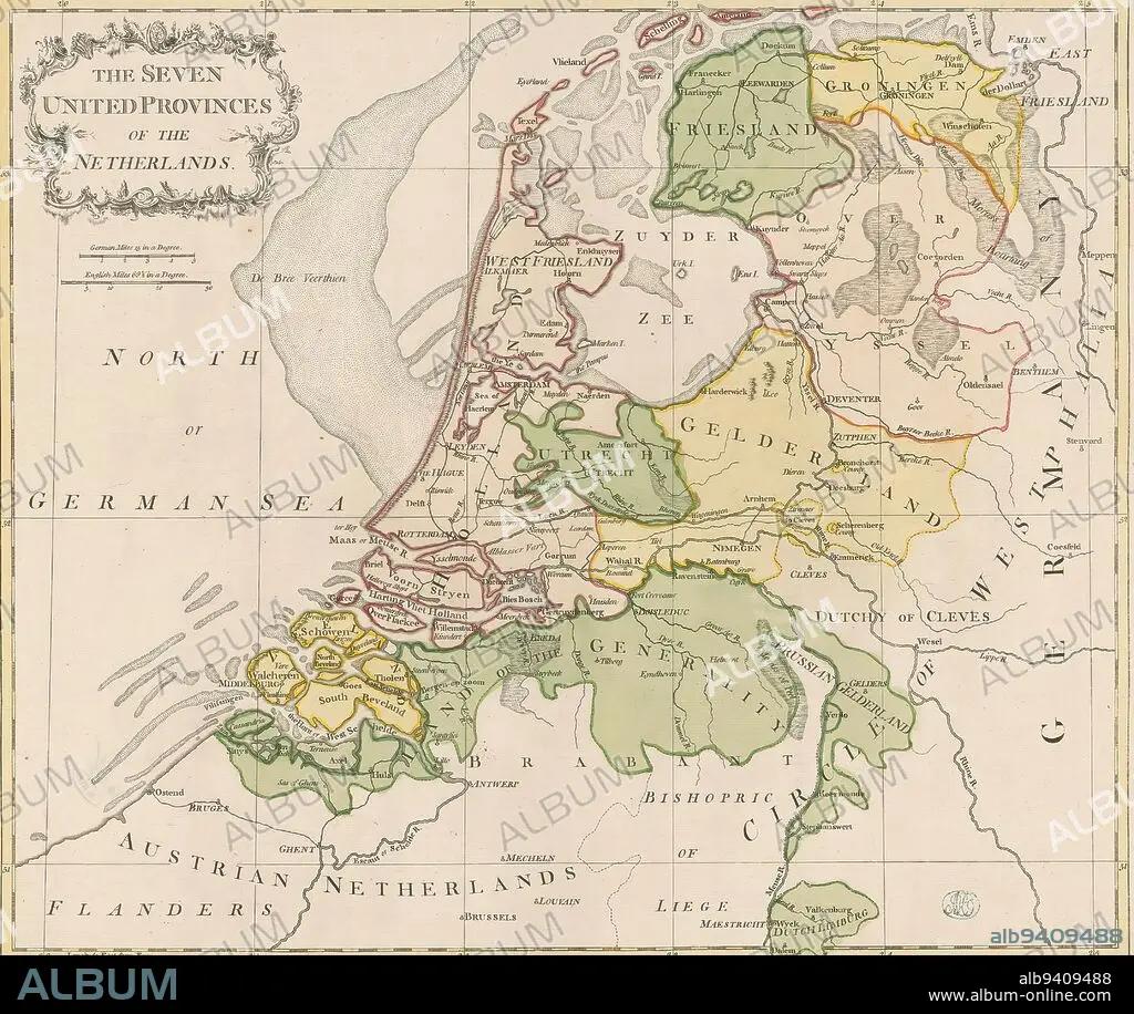
Map of the Republic of the Seven United Netherlands, The Seven Provinces of the Netherlands (title on object), Top left cartouche with title. Below, scale bar: German miles 15 in a degree, English miles 69.5 in a degree. The map is provided with a coordinate net and a degree division along the edges., print maker: John Lodge (I), (mentioned on object), print maker: John Lodge (II), (mentioned on object), print maker: London, print maker: Islington, c. 1780, paper, engraving, height 453 mm × width 541 mm.
| Teilen |
|---|
 Pinterest Pinterest |
 Twitter Twitter |
 Facebook Facebook |
 Link kopieren Link kopieren |
 Email Email |
|
Zu einem anderen Lightbox hinzufügen |
|
Zu einem anderen Lightbox hinzufügen |


Haben Sie bereits ein Konto? Anmelden
Sie haben kein Konto? Registrieren
Dieses Bild kaufen

Untertitel:
Siehe automatische Übersetzung
Map of the Republic of the Seven United Netherlands, The Seven Provinces of the Netherlands (title on object), Top left cartouche with title. Below, scale bar: German miles 15 in a degree, English miles 69.5 in a degree. The map is provided with a coordinate net and a degree division along the edges., print maker: John Lodge (I), (mentioned on object), print maker: John Lodge (II), (mentioned on object), print maker: London, print maker: Islington, c. 1780, paper, engraving, height 453 mm × width 541 mm
Persönlichkeiten:
Bildnachweis:
Album / quintlox
Freigaben (Releases):
Model: Nein - Eigentum: Nein
Rechtefragen?
Rechtefragen?
Bildgröße:
4286 x 3614 px | 44.3 MB
Druckgröße:
36.3 x 30.6 cm | 14.3 x 12.0 in (300 dpi)
Schlüsselwörter:
GRAVUR • JOHN LODGE • KARTE (KARTHOGRAFIE) • KARTEN • KARTHOGRAPHIE • LANDKARTE • LONDON • OBJEKT • PAPIER • PLAN (KARTOGRAPHIE) • REPUBLIK • STICH (KUNST)
