alb5407153
Joan Blaeu, Benin, Guinea, and Mauritania Map, 17th Century
| Teilen |
|---|
 Pinterest Pinterest |
 Twitter Twitter |
 Facebook Facebook |
 Link kopieren Link kopieren |
 Email Email |
|
Zu einem anderen Lightbox hinzufügen |
|
Zu einem anderen Lightbox hinzufügen |


Haben Sie bereits ein Konto? Anmelden
Sie haben kein Konto? Registrieren
Dieses Bild kaufen.
Nutzung auswählen:

Titel:
Joan Blaeu, Benin, Guinea, and Mauritania Map, 17th Century
Untertitel:
Siehe automatische Übersetzung
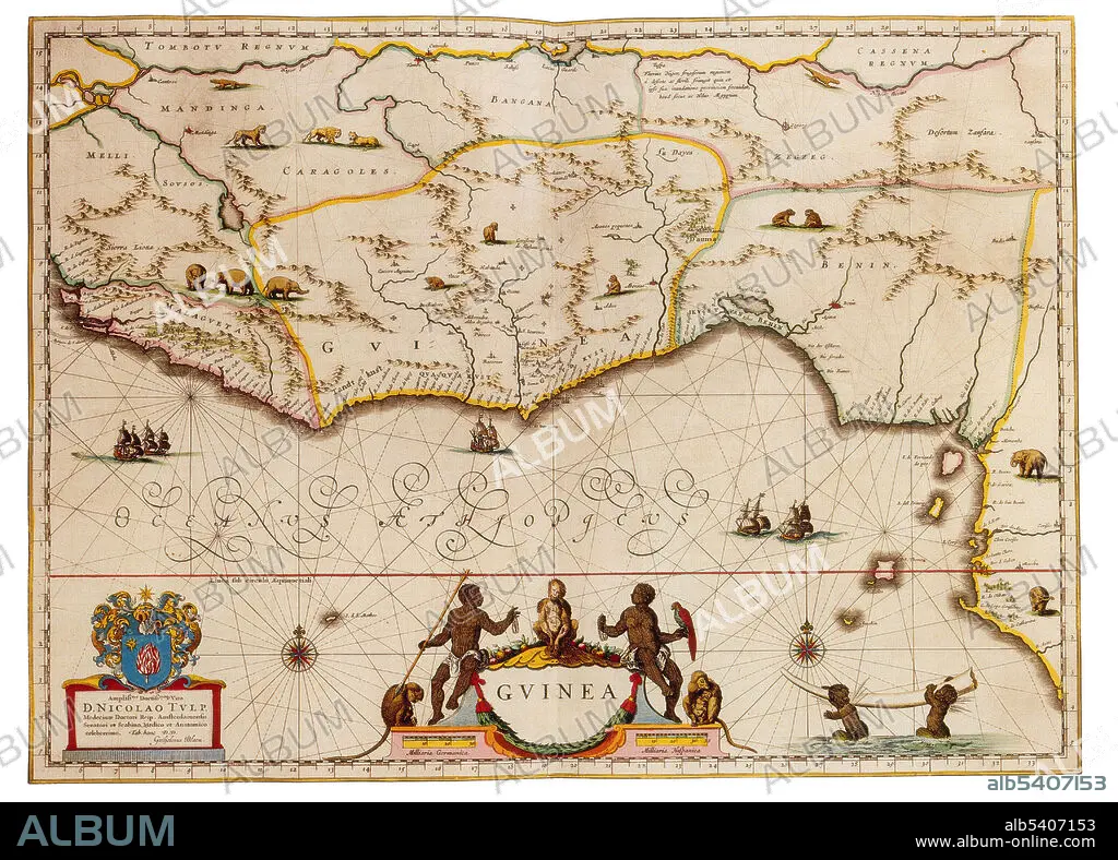
The countries of Benin, Guinea, and Mauritania. West Africa is the westernmost region of Africa. West Africa has been defined as including 17 countries: Benin, Burkina Faso, the island nation of Cape Verde, Gambia, Ghana, Guinea, Guinea-Bissau, Ivory Coast, Liberia, Mali, Mauritania, Niger, Nigeria, the islands of Saint Helena, Ascension and Tristan da Cunha, Senegal, Sierra Leone and Togo. Joan Blaeu (1596-1673) was a Dutch cartographer, the son of cartographer Willem Blaeu. In 1635 they published the Atlas Novus (full title: Theatrum orbis terrarum, sive, Atlas novus) in two volumes. The Atlas Maior is the final version of Joan Blaeu's atlas, published in Amsterdam between 1662 and 1672, in Latin, French, Dutch, German and Spanish, containing 594 maps and around 3,000 pages of text. The Blaeu maps emphasized fine art and colours, being the most expensive of the time.
Persönlichkeiten:
Bildnachweis:
Album / Science Source
Freigaben (Releases):
Bildgröße:
4350 x 3124 px | 38.9 MB
Druckgröße:
36.8 x 26.4 cm | 14.5 x 10.4 in (300 dpi)
Schlüsselwörter:
17. JAHRHUNDERT • 17. JH. • ABENDLÄNDISCH • AFRIKA • BÉNIN • BERÜHMT • BERÜHMTE PERSÖNLICHKEIT • GEOGRAFIE • GEOGRAPHIE • KARTHOGRAFIE • KARTOGRAFIE (KARTE) • KARTOGRAPHIE • NOTABEL • PROMINENZ • WESTEN • WESTERN • WESTLICH • WISSENSCH.: KARTOGRAPHIE
