alb9435044
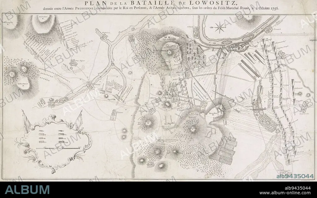
Military map of Lobositz Czech Republic showing the battle of 1 October 1756 between the Prussians and the Austrians This battle was the opening battle of the Seven Years' War 1756-1763, Military Map of Lobositz Plan de la Bataille de Lowositz , Jacob van der Schley, (mentioned on object), intermediary draughtsman: de Oebschelwitz, (mentioned on object), publisher: Pieter de Hondt, (mentioned on object), Amsterdam, publisher: The Hague, 1758, paper, etching, h 651 mm × w 464 mm.
| Teilen |
|---|
 Pinterest Pinterest |
 Twitter Twitter |
 Facebook Facebook |
 Link kopieren Link kopieren |
 Email Email |
|
Zu einem anderen Lightbox hinzufügen |
|
Zu einem anderen Lightbox hinzufügen |


Haben Sie bereits ein Konto? Anmelden
Sie haben kein Konto? Registrieren
Dieses Bild kaufen

Untertitel:
Siehe automatische Übersetzung
Military map of Lobositz Czech Republic showing the battle of 1 October 1756 between the Prussians and the Austrians This battle was the opening battle of the Seven Years' War 1756-1763, Military Map of Lobositz Plan de la Bataille de Lowositz , Jacob van der Schley, (mentioned on object), intermediary draughtsman: de Oebschelwitz, (mentioned on object), publisher: Pieter de Hondt, (mentioned on object), Amsterdam, publisher: The Hague, 1758, paper, etching, h 651 mm × w 464 mm
Bildnachweis:
Album / quintlox
Freigaben (Releases):
Model: Nein - Eigentum: Nein
Rechtefragen?
Rechtefragen?
Bildgröße:
7158 x 4095 px | 83.9 MB
Druckgröße:
60.6 x 34.7 cm | 23.9 x 13.7 in (300 dpi)
Schlüsselwörter:
