alb9635617
JOHN DOWER. Plan of Constantinople and its Suburbs, 1856. Creator: John Dower.
| Teilen |
|---|
 Pinterest Pinterest |
 Twitter Twitter |
 Facebook Facebook |
 Link kopieren Link kopieren |
 Email Email |
|
Zu einem anderen Lightbox hinzufügen |
|
Zu einem anderen Lightbox hinzufügen |


Haben Sie bereits ein Konto? Anmelden
Sie haben kein Konto? Registrieren
Dieses Bild kaufen.
Nutzung auswählen:

Autor:
Titel:
Plan of Constantinople and its Suburbs, 1856. Creator: John Dower.
Untertitel:
Siehe automatische Übersetzung
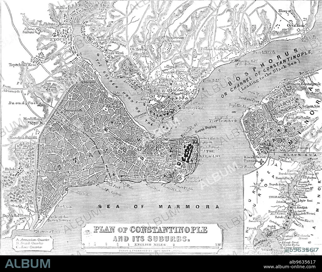
Plan of Constantinople and its Suburbs, 1856. Map showing the city of Constantinople (modern Istanbul, Turkey), including the 'Golden Horn or the Port'; the Bosphorus 'or Channel of Constantinople, leading to the Black Sea'; the Sea of Marmora, the 'Armenian, Frank and Jews' Quarters, pontoon bridge and the Seraglio. From "Illustrated London News", 1856.
Bildnachweis:
Album /Heritage Images
Freigaben (Releases):
Bildgröße:
3607 x 2863 px | 29.5 MB
Druckgröße:
30.5 x 24.2 cm | 12.0 x 9.5 in (300 dpi)
Schlüsselwörter:
DOWER, JOHN • FARBE • FARBIG • GEOGRAFIE • GEOGRAPHIE • ISTANBUL • KUESTE • KÜSTE • MARITIM • SCHWARZ UND WEISS • SCHWARZ-WEISS • SCHWARZWEISS • ZEITUNG
