alb4614710
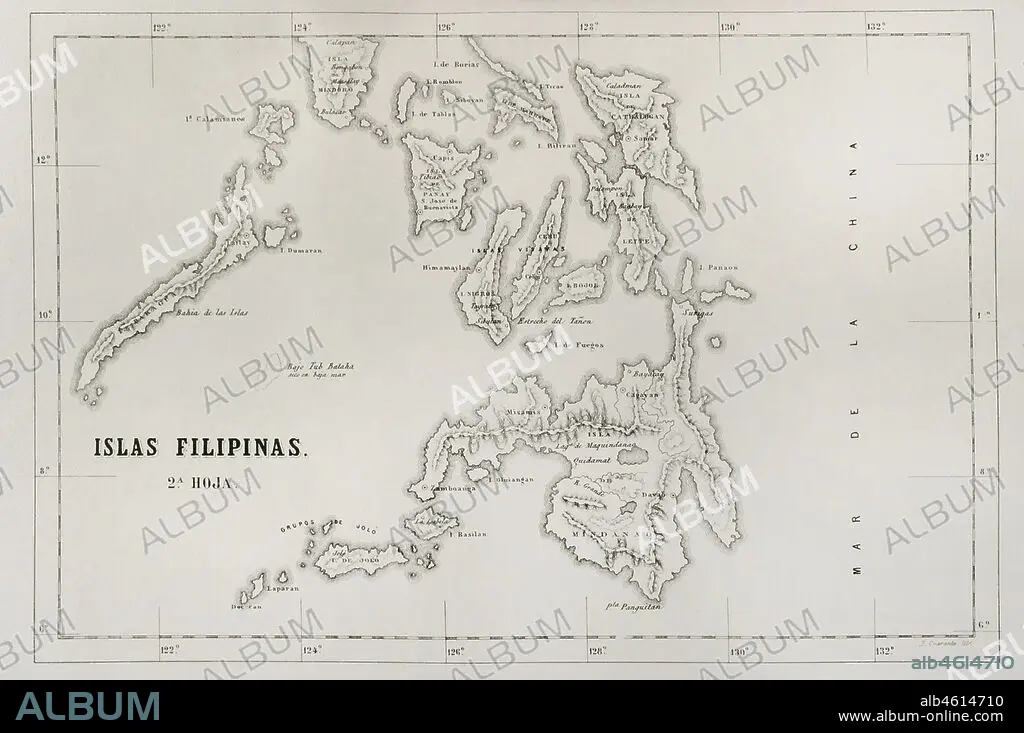
Map of the Philippine islands (Spanish colonial period). Mindanao Island, Visayan Islands and Letye Island. Engraving. Crónica General de España, Historia Ilustrada y Descriptiva de sus Provincias (General Chronicle of Spain, Illustrated and Descriptive History of its Provinces), Philippines, 1871.
| Teilen |
|---|
 Pinterest Pinterest |
 Twitter Twitter |
 Facebook Facebook |
 Link kopieren Link kopieren |
 Email Email |
|
Zu einem anderen Lightbox hinzufügen |
|
Zu einem anderen Lightbox hinzufügen |


Haben Sie bereits ein Konto? Anmelden
Sie haben kein Konto? Registrieren
Dieses Bild kaufen.
Nutzung auswählen:

Untertitel: Siehe automatische Übersetzung
Map of the Philippine islands (Spanish colonial period). Mindanao Island, Visayan Islands and Letye Island. Engraving. Crónica General de España, Historia Ilustrada y Descriptiva de sus Provincias (General Chronicle of Spain, Illustrated and Descriptive History of its Provinces), Philippines, 1871
Map of the Philippine islands (Spanish colonial period). Mindanao Island, Visayan Islands and Letye Island. Engraving. Crónica General de España, Historia Ilustrada y Descriptiva de sus Provincias (General Chronicle of Spain, Illustrated and Descriptive History of its Provinces), Philippines, 1871
Standort: Privatsammlung
Bildnachweis: Album / Prisma
Freigaben (Releases): ? Modellfreigabe: Nein - ? Eigentumsfreigabe: Nein
Rechtefragen?
Rechtefragen?
Bildgröße: 4961 × 3295 px | 46.8 MB
Druckgröße: 42.0 × 27.9 cm | 1953.1 × 1297.2 in (300 dpi)
Schlüsselwörter: ASIEN • ASIEN, KONTINENT • GEOGRAFIE • GEOGRAPHIE • GESCHICHTE • GRAVUR • INSEL • KARTE (KARTHOGRAFIE) • KARTEN • KARTHOGRAFIE • KARTHOGRAPHIE • KARTOGRAFIE (KARTE) • KARTOGRAPHIE • KOLONIALISMUS • KONTINENT, ASIEN • LANDKARTE • MINDANAO • PAZIFIK • PAZIFISCHR OZEAN • PLAN (KARTOGRAPHIE) • PRIVATSAMMLUNG • PROVINZ • STICH (KUNST) • UEBERSEETERRITORIUM • WISSENSCH.: KARTOGRAPHIE • ZEITGESCHICHTE • ÜBERSEETERRITORIUM
