alb4088010
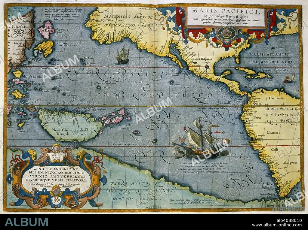
ABRAHAM ORTELIUS. Maris Pacifici. Theatrum Orbis Terrarum. Antwerp, 1595. Map showing the Pacific Ocean and parts of North and South America. Image taken from Theatrum Orbis Terrarum. Originally published/produced in Antwerp, 1595. . Source: Maps.C.2.d.6, 6.
| Share |
|---|
 Pinterest Pinterest |
 Twitter Twitter |
 Facebook Facebook |
 Copy link Copy link |
 Email Email |
|
Add to another lightbox |
|
Add to another lightbox |


Buy this image.
Select the use:

Author: ABRAHAM ORTELIUS (1527-1598)
Caption: Maris Pacifici. Theatrum Orbis Terrarum. Antwerp, 1595. Map showing the Pacific Ocean and parts of North and South America. Image taken from Theatrum Orbis Terrarum. Originally published/produced in Antwerp, 1595. . Source: Maps.C.2.d.6, 6.
Credit: Album / British Library
Image size: 7112 × 4950 px | 100.7 MB
Print size: 60.2 × 41.9 cm | 2800.0 × 1948.8 in (300 dpi)
Keywords: ABRAHAM ORTELIUS • ABRAHAM • AMERICA • AMERICA. • AMERICAS • AMERICAS, THE • CARTE • CARTOGRAPHY • CUBA • FLEET • LATIN AMERICA • LATIN AMERICAN • LATINOAMERICA • MAP MAKING • MAP • MAPS • MARINE • NAVY • OCEAN • OCEAN, PACIFIC • OCEANS • ORTELIUS, ABRAHAM • ORTELLIUS • PACIFIC OCEAN • PLAN (CARTOGRAPHY) • SEA • SEA. • SEAS • SOUTH AMERICA • SUDAMERICA • TOPOGRAPHY • WATER FEATURES
