alb4512613
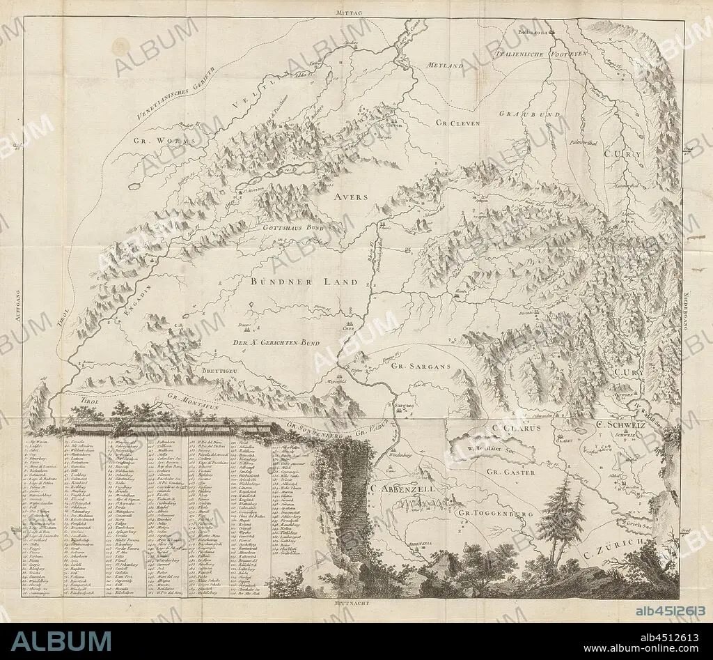
Map of Eastern Switzerland, Map of Grisons, Uri, Glarus, Appenzell, Zurich with inscription of the mountains, etching, plate 15, after S. IX (part 2), 1760, Gottlieb Sigmund Gruner: Die Eisgebirge des Schweizerlandes. Bern: Abraham Wagner, Sohn. 1760.
| Share |
|---|
 Pinterest Pinterest |
 Twitter Twitter |
 Facebook Facebook |
 Copy link Copy link |
 Email Email |
|
Add to another lightbox |
|
Add to another lightbox |


Buy this image.
Select the use:

Caption:
Map of Eastern Switzerland, Map of Grisons, Uri, Glarus, Appenzell, Zurich with inscription of the mountains, etching, plate 15, after S. IX (part 2), 1760, Gottlieb Sigmund Gruner: Die Eisgebirge des Schweizerlandes. Bern: Abraham Wagner, Sohn. 1760.
Credit:
Album / quintlox
Releases:
Image size:
5778 x 5045 px | 83.4 MB
Print size:
48.9 x 42.7 cm | 19.3 x 16.8 in (300 dpi)
Keywords:
1760 • 9TH CENTURY • 9TH • ABRAHAM WAGNER • APPENZELL • BERN • DIE EISGEBIRGE DES SCHWEIZERLANDES • EASTERN SWITZERLAND • ETCHING • GLARUS • GOTTLIEB SIGMUND GRUNER • GRISONS • INSCRIPTION • MAP • MAPS • MOUNTAIN RANGE • MOUNTAINS • PART 2 • PLAN (CARTOGRAPHY) • PLATE 15 • RANGE • SIERRA • SOHN • URI • ZURICH
