alb8369703
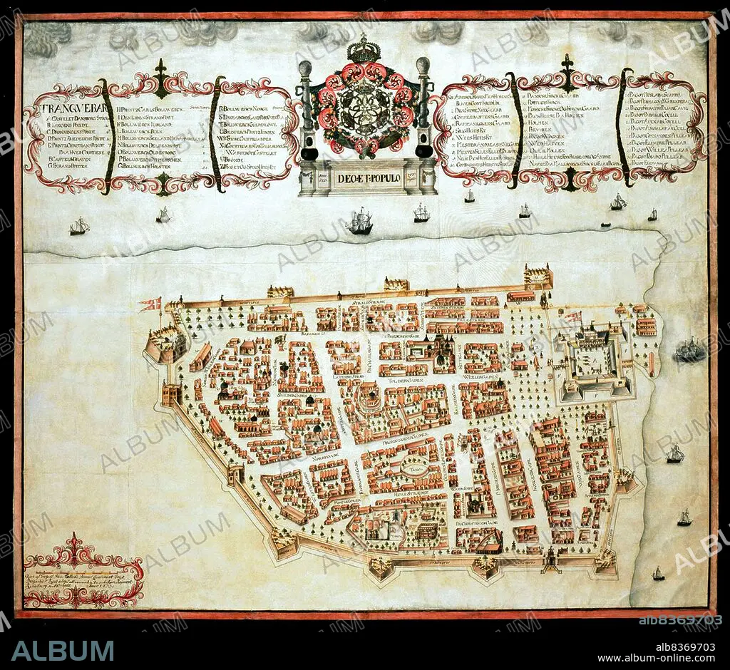
India / Denmark: Map of Tranquebar (Tharangambadi) showing Fort Dansborg, Giorf af Gregers,1733, The Royal Library, Copenhagen
| Share |
|---|
 Pinterest Pinterest |
 Twitter Twitter |
 Facebook Facebook |
 Copy link Copy link |
 Email Email |
|
Add to another lightbox |
|
Add to another lightbox |


Buy this image.
Select the use:

Title: India / Denmark: Map of Tranquebar (Tharangambadi) showing Fort Dansborg, Giorf af Gregers,1733, The Royal Library, Copenhagen
Caption: Tharangambadi, formerly Tranquebar, is a town in the Nagapattinam district of the Indian state of Tamil Nadu. It lies 15 kilometres (9.3 mi) north of Karaikal, near the mouth of a distributary of the Kaveri River.
. It was a Danish colony from 1620 to 1845, and in Danish it is still known as Trankebar.
. It was a Danish colony from 1620 to 1845, and in Danish it is still known as Trankebar.
Credit: Album / Universal Images Group / Pictures From History
Releases: ? Model Release: No - ? Property Release: No
Rights questions?
Rights questions?
Image size: 4700 × 4073 px | 54.8 MB
Print size: 39.8 × 34.5 cm | 1850.4 × 1603.5 in (300 dpi)
Keywords: 1733 • 18TH CENTURY • 18TH CENTURY, THE • 18TH CENTURY. • 18TH • ASIATIC COMPANY • ASIATISK KOMPAGNI • BOUTIQUE • CARDS • CARTOGRAPHY • CHART • CHARTS • COLONIALISM • COMMERCE • DANISH EAST INDIA COMPANY • DANISH • DENMARK • ECONOMY • FORT DANSBORG • IMPERIALISM • INDIA • INDIAN • INDIGENOUS PEOPLES OF THE AMERICAS • INDIO • MAP MAKING • MAP • MAPS • OSTINDISK KOMPAGNI • PLAN (CARTOGRAPHY) • TAMIL NADU • THARANGAMBADI • TRADE • TRADING • TRANKEBAR • TRANQUEBAR • XVIII CENTURY
