alb5400279
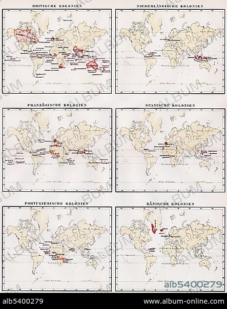
Historic illustration, world maps showing the colonies of Great Britain, Netherlands, France, Spain, Portugal and Denmark, 19th century, Meyers Konversations-Lexikon encyclopedia, 1889, Europe.
| Share |
|---|
 Pinterest Pinterest |
 Twitter Twitter |
 Facebook Facebook |
 Copy link Copy link |
 Email Email |
|
Add to another lightbox |
|
Add to another lightbox |


Caption:
Historic illustration, world maps showing the colonies of Great Britain, Netherlands, France, Spain, Portugal and Denmark, 19th century, Meyers Konversations-Lexikon encyclopedia, 1889, Europe
Credit:
Album / ImageBroker / H.-D. Falkenstein
Releases:
Model: No - Property: No
Rights questions?
Rights questions?
Image size:
465 x 600 px | 817.4 KB
Print size:
3.9 x 5.1 cm | 1.6 x 2.0 in (300 dpi)
Keywords:
19TH CENTURY • AGE • ÂGÉS • AUS • BOOK • BOOKING • BOOKS • CADRE • CARD • CARDBOARD • CARDS • CHARTS • COLONIES • COLONY • DANMARK • DEMONSTRATING • DENMARK • DEPICTION • DEPICTIONS • DRAWING • DRAWINGS • ENCYCLOPEDIA • ENCYLOPEDIAS • ENGLAND • ESPAñA • EUROPE • FIGURE • FIGURES • FRANCE • GEOGRAPHIC • GEOGRAPHICAL • GEOGRAPHY • GREAT BRITAIN • HAARLEM, TOWNSCAPE (NL) • HISTORIC • HISTORICAL • HISTORY NETHERLANDS • HISTORY • HISTORY, NETHERLANDS • HOLLAND • ILLUSTRATION • ILLUSTRATIONS • IMAGE MOTIF • IMAGES • IN PAINTINGS • INTERIORS: IN PAINTINGS • LABOR • LABOUR • LANDSCAPE, NETHERLANDS • MAP OF THE WORLD • MAP • MAPS • MEYERS KONVERSATIONS-LEXIKON • MEYERS LEXIKON • NEDERLAND • NETHERLAND LANDSCAPE • NETHERLANDS • NETHERLANDS, HISTORY • NETHERLANDS, LANDSCAPE • NETHERLANDS, THE • NINETEENTH CENTURY • NéERLANDAIS • OLD AGE • OLD • PAINTING (ACTIVITY) • PAINTING • PAINTINGS • PICTURE • PICTURES • PORTUGAL • REFERENCE BOOK • REFERENCE BOOKS • ROAD MAP • ROAD MAPS • ROOKERY • SHOW • SHOWING • SHOWS • SKETCH • SKETCHES • SPAIN • TENEMENT • TOWNSCAPE: HAARLEM (NL) • UK • UNITED KINGDOM • WORK • WORKING • WORKS • WORLD MAP • WORLD MAPS
