alb1463736
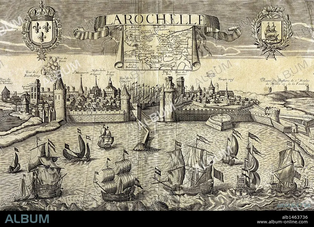
La Rochelle. Map of the city on the Atlantic. Sixteenth-century engraving by Jollain.
| Share |
|---|
 Pinterest Pinterest |
 Twitter Twitter |
 Facebook Facebook |
 Copy link Copy link |
 Email Email |
|
Add to another lightbox |
|
Add to another lightbox |


Buy this image.
Select the use:

Caption: La Rochelle. Map of the city on the Atlantic. Sixteenth-century engraving by Jollain.
Credit: Album / Prisma
Releases: ? Model Release: No - ? Property Release: No
Rights questions?
Rights questions?
Image size: 4983 × 3345 px | 47.7 MB
Print size: 42.2 × 28.3 cm | 1961.8 × 1316.9 in (300 dpi)
Keywords: 16 16TH XVI XVITH SIXTEENTH CENTURY • 16 CENTURY • 16TH CENTURY • 16TH • ATLANTIC COAST • ATLANTIC OCEAN • ATLANTIC • BARGE • BARK • BARQUE • BOAT • BOATS • BREAKWATER • BUQUE • CARTOGRAPHY • CHARENTE-MARITIME DEPARTMENT • CITY • COAST • COASTAL POPULATION • COASTAL • COASTLINE • CRAFT • DIAGRAM • DOCK • EMBARKATION • ENGRAVED • ENGRAVING (ARTWORK) • ENGRAVING • ENGRAVING. • ENGRAVINGS • ETCHING • FLEET • FRANCE • FRANCE. • FRANCIA • FRANKREICH • FRENCH • FRIGATE • HAMLET • HARBOR • HARBOUR • HISTORIA UNIVERSAL • HISTORIA • HISTORY • HISTORY. • JETTY • JOLLAIN RECORDER • JOLLAIN • LA FRANCE • LA ROCHELLE • LITTORAL • MANOR HOUSE • MANSION • MAP MAKING • MAP • MAPPING • MAPS • MAR ATLANTICO • MARINE • MARITIME NAVIGATION • MARITIME • MODERN AGE • MODERN ERA • MODERN PERIOD • MOORING • NAVE • NAVEGATION • NAVIGATION • NAVIO • NAVY • OCEAN • OCEAN, ATLANTIC • OCEANS • PIER • PLAN (CARTOGRAPHY) • PLAN • PLANE • PLANT • PLANTA • PLANTAE • PLANTS • PORT • PRINT • PUERTO • ROCHELLE • SAILING • SEA • SEA. • SEAS • SEASHORE • SEASIDE • SHIP • SHIP: EMBARKATION • SHIPPING • SHIPS BOW • SHIPS • SHORELINE • URBANISM • URBE • VESSEL • VILLA • VILLAGE • WESTERN • WHARF • XVI CENTURY
