alb1648803
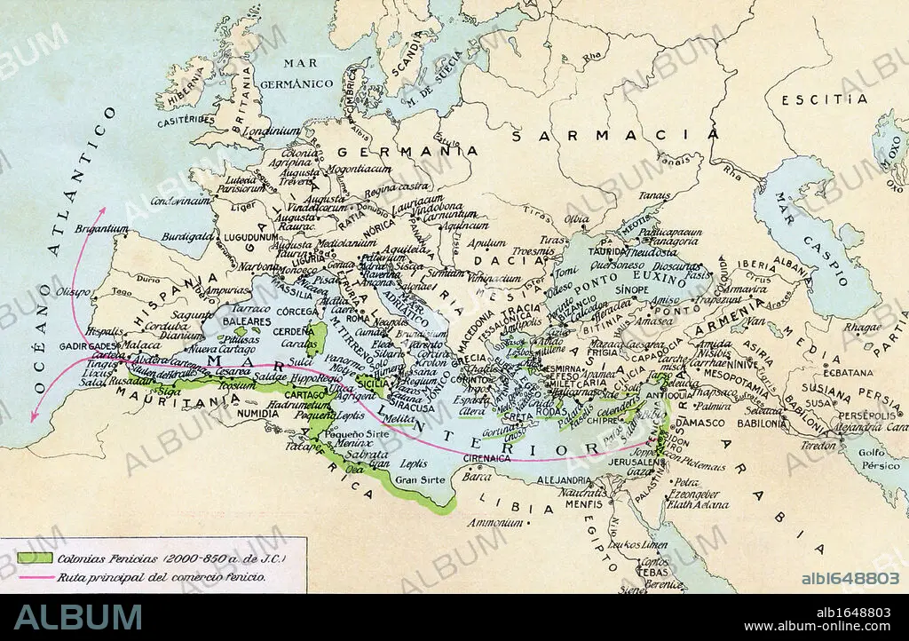
Phoenician colonies and area of influence in the Mediterranean 200 to 850 B.C. Green shows colonized areas. Red shows principal routes of Phoenician commerce. From Historia de las Naciones published circa 1921.
| Share |
|---|
 Pinterest Pinterest |
 Twitter Twitter |
 Facebook Facebook |
 Copy link Copy link |
 Email Email |
|
Add to another lightbox |
|
Add to another lightbox |


Buy this image.
Select the use:

Caption:
Phoenician colonies and area of influence in the Mediterranean 200 to 850 B.C. Green shows colonized areas. Red shows principal routes of Phoenician commerce. From Historia de las Naciones published circa 1921.
Category:
UIG HISTORY
Credit:
Album / Universal History Archive/Universal Images Group
Releases:
Image size:
5457 x 3563 px | 55.6 MB
Print size:
46.2 x 30.2 cm | 18.2 x 11.9 in (300 dpi)
Keywords:
ANCIENT • ANTIQUE • AREA • BOUTIQUE • CITIES • CITY • CIUDAD • COLONIES • COLONY • COMMERCE • COMMERCIAL • ECONOMY • FLEET • ILLUSTRATION • ILLUSTRATIONS • ILUSTRATION • INFLUENCE • KEN • MAP • MAPS • MARINE • MEDITERRANEAN • NAVY • OCEAN • OCEANS • OLD • PHOENICIA • PHOENICIAN • PLAN (CARTOGRAPHY) • ROUTE • ROUTES • SEA • SEA. • SEAS • TOWN • TOWNS • TRADE • TRADING • UIG HISTORY • WELSH
