alb4092338
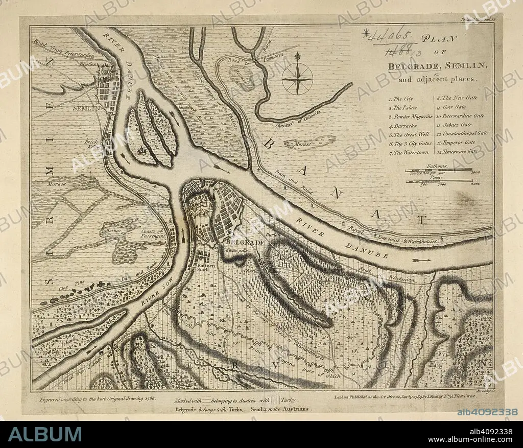
A plan of Belgrade. Plan of Belgrade, S. and adjacent places. 1789. Source: Maps * 44065.(13.). Language: English.
| Share |
|---|
 Pinterest Pinterest |
 Twitter Twitter |
 Facebook Facebook |
 Copy link Copy link |
 Email Email |
|
Add to another lightbox |
|
Add to another lightbox |


Buy this image.
Select the use:

Caption:
A plan of Belgrade. Plan of Belgrade, S. and adjacent places. 1789. Source: Maps * 44065.(13.). Language: English.
Personalities:
Credit:
Album / British Library
Releases:
Model: No - Property: No
Rights questions?
Rights questions?
Image size:
5918 x 4763 px | 80.6 MB
Print size:
50.1 x 40.3 cm | 19.7 x 15.9 in (300 dpi)
Keywords:
18TH CENTURY • 18TH CENTURY, THE • 18TH • ARCHIVE • ARCHIVES • BALCANES • BALKAN • BALKANS • BELGRADE • DOCUMENT • EUROPA • EUROPE • PLAN • SERBIA • SOUTHEASTERN EUROPE • SOUTHERN EUROPE • XVIII CENTURY • YUGOSLAVIA
