alb5412020
Kilauea Eruption, May 2018

|
Add to another lightbox |
|
Add to another lightbox |


Buy this image.
Select the use:

Title:
Kilauea Eruption, May 2018
Caption:
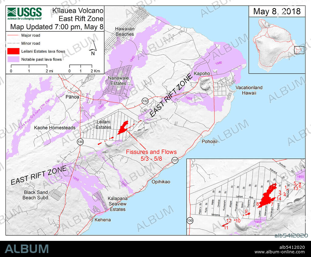
Map showing the fissures and lava flows from Kilauea's lower East Rift Zone eruption, as of 7:00 p.m. HST, May 8, 2018. Shaded purple areas indicate lava flows erupted in 1840, 1955, 1960, and 2014-2015. The 2018 lava flows are in red. Compare with the map from June 25 (SS21449783) to see how the lava flows have expanded and changed the coastline.
Credit:
Album / Science Source / U.S. Geological Survey
Releases:
Model: No - Property: No
Rights questions?
Rights questions?
Image size:
3300 x 2550 px | 24.1 MB
Print size:
27.9 x 21.6 cm | 11.0 x 8.5 in (300 dpi)
Keywords:
2018 ERUPTION • AMERICA • BIG ISLAND • COMPARE • DIAGRAM • EARTH SCIENCE • EASTERN RIFT ZONE • FISSURE 8 • GEOGRAPHY • GEOLOGIA • GEOLOGY • HAWAI'I • HAWAII • HAWAIIAN ISLANDS • HISTORY • ILLUSTRATION • ILLUSTRATIONS • KAPOHO BAY • KILAUEA VOLCANO • LAVA FLOW FIELD • LEILANI ESTATES • LOWER EAST RIFT ZONE • MAP • NATURAL DISASTER • USA • USGS • VACATIONLAND • VOLCANO • VULCAN • VULCANO
 Pinterest
 Twitter
 Facebook
 Copy link
 Email
Email
