alb3841132
Global Warming, Iceberg B-15A
| Share |
|---|
 Pinterest Pinterest |
 Twitter Twitter |
 Facebook Facebook |
 Copy link Copy link |
 Email Email |
|
Add to another lightbox |
|
Add to another lightbox |


Buy this image.
Select the use:

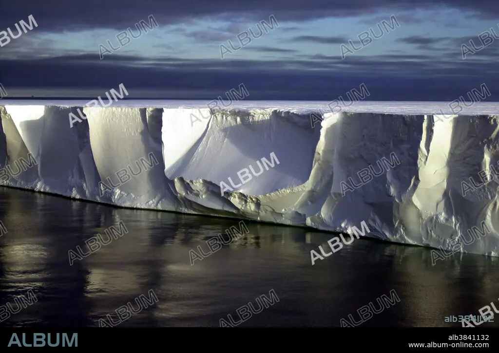
Title: Global Warming, Iceberg B-15A
Caption: Northern edge of the giant iceberg B-15A, located close to Ross Island, Antarctica. Iceberg B-15A is a fragment of a larger iceberg (B-15) that broke away from the Ross Ice Shelf in March 2000. Researchers have placed GPS, weather monitoring stations and four seismometers on different icebergs to track them. The goal is to learn more about what causes icebergs to calve, how and why they drift, what happens when the icebergs warm, and why they are producing previously unknown tremors that are picked up on seismometers as far away as Tahiti. In 2005 prevailing currents took B-15A past the Drygalski ice tongue; the collision broke off the tip of Drygalski in mid-April. Iceberg B-15A sailed on along the coast leaving McMurdo Sound until it ran aground off Cape Adare in Victoria Land, where it broke into several smaller pieces on Oct. 27/28, 2005. The largest piece is still named B-15A , additional pieces were named B-15P, B-15M and B-15N. It has since moved farther up north and broken up into more pieces.
Category: landscapes • Geology & Fossils
Credit: Album / Science Source / NSF/Josh Landis
Releases: ? Model Release: No - ? Property Release: No
Rights questions?
Rights questions?
Image size: 2000 × 1312 px | 7.5 MB
Print size: 16.9 × 11.1 cm | 787.4 × 516.5 in (300 dpi)
Keywords: 2000S • 21ST CENTURY • 21ST • 21TH CENTURY • ANTARCTICA • CLIMATE CHANGE • CLIMATOLOGY • EARTH SCIENCE • ENVIRONMENT • FLEET • GEOLOGY & FOSSILS • GLACE • GLOBAL CLIMATE • GLOBAL WARMING • ICE (WEATHER) • ICE • ICE, FROZEN LAKES&STREAMS • ICEBERG B-15 • ICEBERG B-15A • ICEBERG B15 • ICEBERG B15A • ICEBERG RESEARCH • ICEBERG • LANDSCAPES • MARINE • NATIONAL SCIENCE FOUNDATION • NAVY • NSF • OCEAN • OCEANS • RESEARCH • ROSS ICE SHELF • ROSS ISLAND • SCIENCE • SEA • SEA. • SEAS • SNOW
