alb3921049
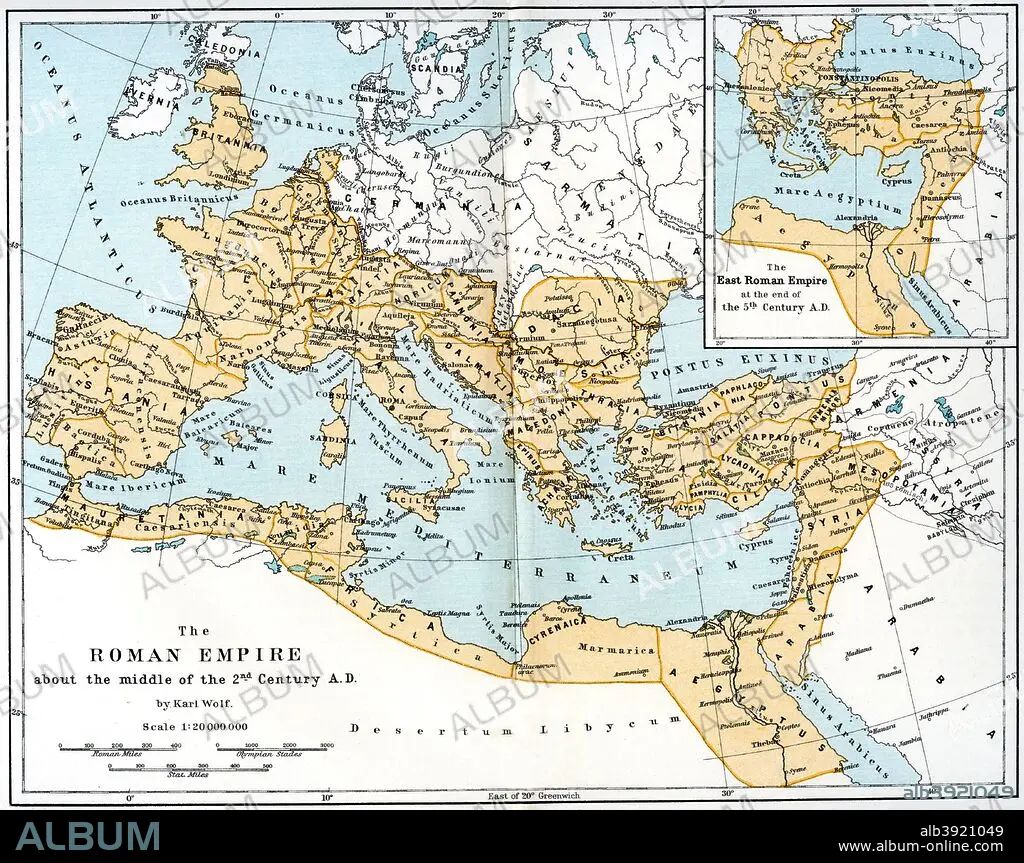
Map of the Roman Empire, 2nd century AD, (1902). Artist: Unknown
| Share |
|---|
 Pinterest Pinterest |
 Twitter Twitter |
 Facebook Facebook |
 Copy link Copy link |
 Email Email |
|
Add to another lightbox |
|
Add to another lightbox |


Buy this image.
Select the use:

Title:
Map of the Roman Empire, 2nd century AD, (1902). Artist: Unknown
Caption:
Map of the Roman Empire, 2nd century AD, (1902). Map showing the extent of the Roman Empire about the middle of the 2nd century. Illustration from 'The World's History, The Mediterranean Nations, by Dr H F Helmolt, Volume IV, published by William Heinemann, (London, 1902).
Credit:
Album / The Print Collector / Heritage Images
Releases:
Image size:
4706 x 3723 px | 50.1 MB
Print size:
39.8 x 31.5 cm | 15.7 x 12.4 in (300 dpi)
Keywords:
1900S • 1990S • 20TH CENTURY • 2ND CENTURY • 90S • ANCIENT ROME • ANCIENT WORLD • ATLANTIC OCEAN • ATLANTIC • CENTURY • COAST • COLOR • COLOUR • CONTINENT • COUNTRY • DR H F HELMOLT • EMPIRE • EUROPE • FLEET • FLUSH • H F HELMOLT • H F • HANS F (HANS FERDINAND) • HANS F • HANS FERDINAND HELMOLT • HANS FERDINAND • HELMOLT • HF HELMOLT • HF • ITALIA • ITALY • LOCATION • MAP • MARINE • MEDITERRANEAN SEA • MEDITERRANEAN • NAVY • NINETIES • NINETIES, THE • NINETY DECADE • OCEAN • OCEAN, ATLANTIC • OCEANS • ROMAN EMPIRE • ROMAN • ROME • SEA • SEA. • SEAS
