alb5481404
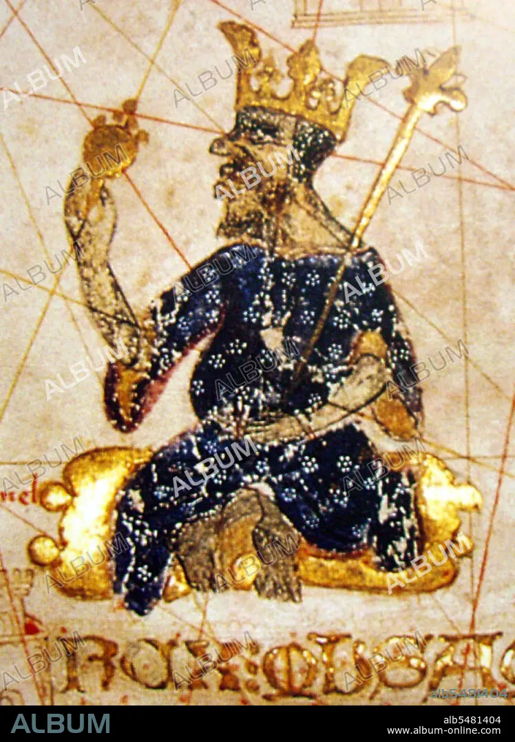
Mansa Musa, King of Mali, holding a sceptre and a piece of gold. Detail from the Catalan Atlas,1375.
| Share |
|---|
 Pinterest Pinterest |
 Twitter Twitter |
 Facebook Facebook |
 Copy link Copy link |
 Email Email |
|
Add to another lightbox |
|
Add to another lightbox |


Buy this image.
Select the use:

Title: Mansa Musa, King of Mali, holding a sceptre and a piece of gold. Detail from the Catalan Atlas,1375.
Caption: Musa I (c. 1280 - c. 1337), commonly referred to as Mansa Musa, was the tenth mansa, which translates as 'king of kings' or 'emperor', of the Malian Empire. At the time of Mansa Musa's rise to the throne, the Malian Empire consisted of territory formerly belonging to the Ghana Empire and Melle (Mali) and immediate surrounding areas. Musa held many titles, including Emir of Melle, Lord of the Mines of Wangara, and conqueror of Ghanata, Futa-Jallon, and at least another dozen states. He was the wealthiest West African ruler of his day. The Catalan Atlas (1375) is the most important Catalan map of the medieval period. It was produced by the Majorcan cartographic school and is attributed to Cresques Abraham, a Jewish book illuminator who was self-described as being a master of the maps of the world as well as compasses. It has been in the royal library of France (now the Bibliotheque nationale de France) since the late 14th century.
Credit: Album / Pictures From History/Universal Images Group
Releases: ? Model Release: No - ? Property Release: No
Rights questions?
Rights questions?
Image size: 3550 × 4860 px | 49.4 MB
Print size: 30.1 × 41.1 cm | 1397.6 × 1913.4 in (300 dpi)
Keywords: AFRICA • AFRICAN • ART • ARTS • CARTOGRAPHY • CATALAN ATLAS • CHART • GOLD • GOLD, ALL • GOLDEN TRADE OF THE MOORS • GOLDEN • GOLDSMITH • ILLUMINATION • ISLAM • ISLAMIC CULTURE • ISLAMISM • KING • LEGEND • MALI • MALIAN • MANSA MUSA • MAP MAKING • MAP • MAPS • MONARCH • MONARCHY • MUSLIM • PAINT • PAINTING • PAINTINGS • PLAN (CARTOGRAPHY) • RELIGION • RULER • SAHEL • TIMBUKTU • WEST AFRICA
