alb8361253
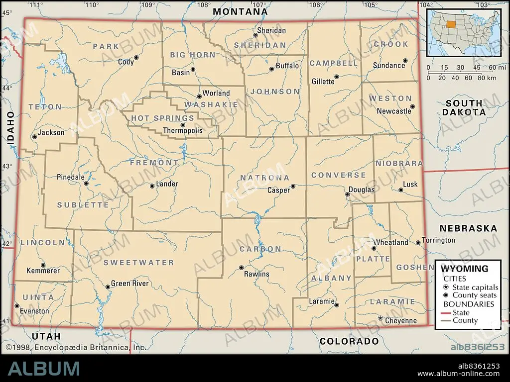
Political map of Wyoming
| Share |
|---|
 Pinterest Pinterest |
 Twitter Twitter |
 Facebook Facebook |
 Copy link Copy link |
 Email Email |
|
Add to another lightbox |
|
Add to another lightbox |


Buy this image.
Select the use:

Caption:
Political map of Wyoming
Credit:
Album / Universal Images Group / Encyclopaedia Britannica
Releases:
Image size:
3825 x 2672 px | 29.2 MB
Print size:
32.4 x 22.6 cm | 12.7 x 8.9 in (300 dpi)
Keywords:
20 20TH XX XXTH TWENTIETH CENTURY • 20 XX TWENTIETH CENTURY • 20TH CENTURY • 20TH • ALBANY • AMERICA • AMERICA. • AMERICAS • AMERICAS, THE • BIG HORN • CARBON • CARTOGRAPHY • CODY • CONVERSE • COUNTIES • COUNTY SEATS • COUNTY • CROOK • DETAIL • EEUU • EXPLORATION • FREMONT • GEOGRAFIA • GEOGRAPHICAL • GEOGRAPHY • GILLETTE • GOSHEN • HORIZONTAL • JACKSON • LARAMIE • LOCATOR • MAP MAKING • MAP • MAPS • NATRONA • NORTH AMERICA • NORTH AMERICAN • PLAN (CARTOGRAPHY) • POLITICAL MAP • SHERIDAN • STATE • STATES • SUBLETTE • TETON • TWENTIETH CENTURY • U. S. A • U. S. A. • UINTA • UNITED STATES AMERICA • UNITED STATES OF AMERICA • UNITED STATES • US • USA • USA. UNITED STATES • WEST • WESTERN STATES • WESTON • WYOMING
