alb4946376
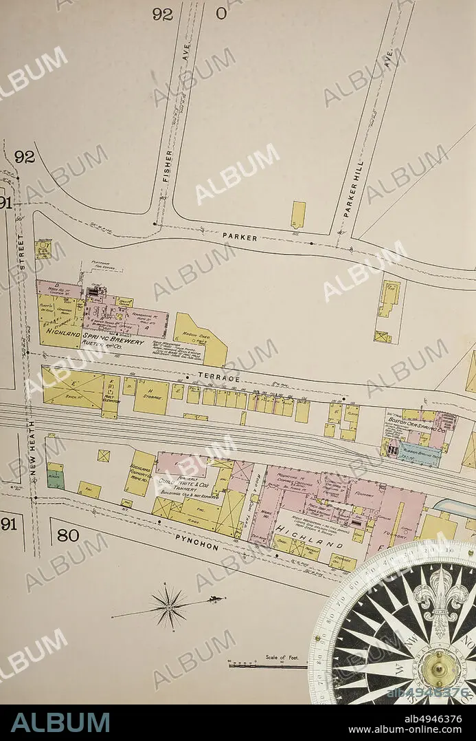
Image 37 of Sanborn Fire Insurance Map from Boston, Suffolk County, Massachusetts. Vol. 3, 1888. 81 Sheet(s). Includes Roxbury, West Roxbury, Parts of Brighton, Brookline. Double-paged plates numbered 62-100. Bound, America, street map with a Nineteenth Century compass.
| Share |
|---|
 Pinterest Pinterest |
 Twitter Twitter |
 Facebook Facebook |
 Copy link Copy link |
 Email Email |
|
Add to another lightbox |
|
Add to another lightbox |


Caption:
Image 37 of Sanborn Fire Insurance Map from Boston, Suffolk County, Massachusetts. Vol. 3, 1888. 81 Sheet(s). Includes Roxbury, West Roxbury, Parts of Brighton, Brookline. Double-paged plates numbered 62-100. Bound, America, street map with a Nineteenth Century compass
Credit:
Album / quintlox
Releases:
Model: No - Property: No
Rights questions?
Rights questions?
Image size:
4500 x 6647 px | 85.6 MB
Print size:
38.1 x 56.3 cm | 15.0 x 22.2 in (300 dpi)
Keywords:
1888 • 3 • 81 SHEET (S) • AMERICA • AMERICAS • ATLAS • BOSTON • BOUND • BROOKLINE • CARTOGRAPHY • CITY • DOUBLE-PAGED PLATES NUMBERED 62-100 • EEUU • GEOGRAPHY • IMAGE 37 • INCLUDES ROXBURY • JOURNEY • JOURNEYMAN'S TRAVEL • JOURNEYMAN'S TRAVELS • LANDMARK • LEISURE • MAP MAKING • MASSACHUSETTS • NINETEENTH CENTURY COMPASS • OLD • OUTDOOR • OUTDOORS • OUTSIDE • PARTS OF BRIGHTON • ROAD • ROADS • RUA • SANBORN FIRE INSURANCE MAP • STREET MAP • STREET • STREETS • SUFFOLK COUNTY • TOWN • TOWNS • TRAVEL • TRAVELING • TRIP • UNITED STATES • URBAN • VIA • VINTAGE • VOL • WAY • WEST ROXBURY
