alb2603576
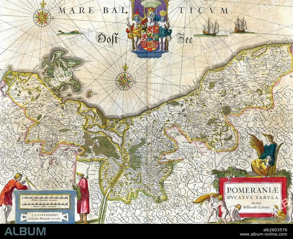
Map of the historical Duchy of Pomerania.
| Share |
|---|
 Pinterest Pinterest |
 Twitter Twitter |
 Facebook Facebook |
 Copy link Copy link |
 Email Email |
|
Add to another lightbox |
|
Add to another lightbox |


Buy this image.
Select the use:

Title: Map of the historical Duchy of Pomerania.
Caption: Map of the historical Duchy of Pomerania. The Duchy of Pomerania 12th century – 1637 was a duchy in Pomerania on the southern coast of the Baltic Sea, ruled by dukes of the House of Pomerania (Griffins). Dated 1635.
Credit: Album / Universal Images Group / Universal History Archive
Releases: ? Model Release: No - ? Property Release: No
Rights questions?
Rights questions?
Image size: 5100 × 3893 px | 56.8 MB
Print size: 43.2 × 33.0 cm | 2007.9 × 1532.7 in (300 dpi)
Keywords: 1630S • 17TH CENTURY • 17TH CENTURY. • 17TH • 17TH-CENTURY • COMMUNISM: POLAND • GERMANY • GRIFFINS • MAP • MAPS • PLAN (CARTOGRAPHY) • POLAND • POLAND: COMMUNISM • POLAND: POSTWAR • POMERANIA • POSTWAR: POLAND • XVII CENTURY
