alb4088250
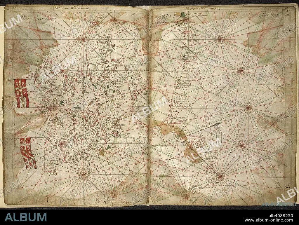
PIETRO VESCONTE. Portolan chart of the Eastern Mediterranean, with Greece, Turkey, the Black Sea, and Crete. Maps of the Liber Secretorum Fidelium Crucis. Italy (Venice); circa 1320-1325. Source: Add. 27376*, ff.183v-184. Language: Latin.
| Share |
|---|
 Pinterest Pinterest |
 Twitter Twitter |
 Facebook Facebook |
 Copy link Copy link |
 Email Email |
|
Add to another lightbox |
|
Add to another lightbox |


Buy this image.
Select the use:

Author: PIETRO VESCONTE
Caption: Portolan chart of the Eastern Mediterranean, with Greece, Turkey, the Black Sea, and Crete. Maps of the Liber Secretorum Fidelium Crucis. Italy (Venice); circa 1320-1325. Source: Add. 27376*, ff.183v-184. Language: Latin.
Credit: Album / British Library
Releases: ? Model Release: No - ? Property Release: No
Rights questions?
Rights questions?
Image size: 6846 × 4798 px | 94.0 MB
Print size: 58.0 × 40.6 cm | 2695.3 × 1889.0 in (300 dpi)
Keywords: 14TH CENTURY • 14TH • 14TH-CENTURY • ARCHIVE • ARCHIVES • BALCANES • BALKAN • BALKANS • CARTE • CARTOGRAPHIC • CARTOGRAPHY • CHART • COLOR • COLORS • COLOUR • COLOURS • CRETE • DOCUMENT • EUROPA • EUROPE • FLUSH • FOURTEENTH CENTURY • GREECE • MANUSCRIPT • MAP MAKING • MAP • MAPS • MEDITERRANEAN SEA • MEDITERRANEAN • PIETRO VESCONTE • PLAN (CARTOGRAPHY) • SOUTHEASTERN EUROPE • SOUTHERN EUROPE • TURKEY • XIV CENTURY
