alb1960835
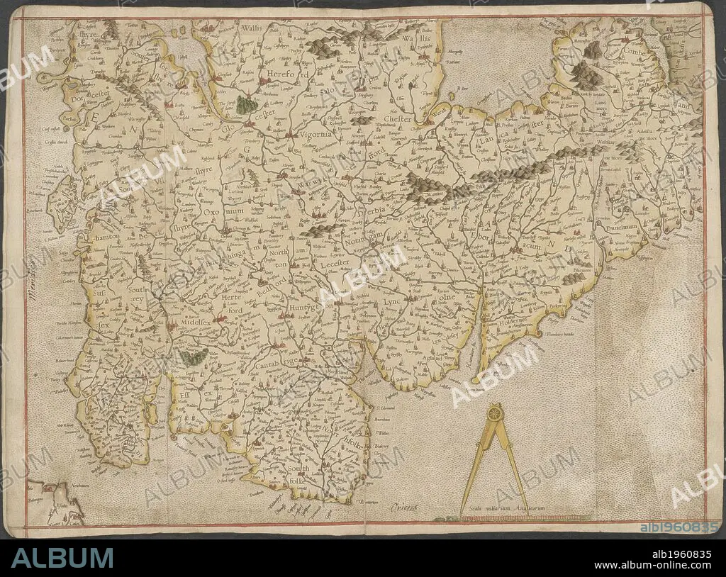
England. The Mercator atlas of Europe. 1570-1572. Map of England. Image taken from The Mercator atlas of Europe. Originally published/produced in 1570-1572. . Source: Maps.C.29.c.13.
| Share |
|---|
 Pinterest Pinterest |
 Twitter Twitter |
 Facebook Facebook |
 Copy link Copy link |
 Email Email |
|
Add to another lightbox |
|
Add to another lightbox |


Buy this image.
Select the use:

Caption:
England. The Mercator atlas of Europe. 1570-1572. Map of England. Image taken from The Mercator atlas of Europe. Originally published/produced in 1570-1572. . Source: Maps.C.29.c.13.
Credit:
Album / British Library
Releases:
Model: No - Property: No
Rights questions?
Rights questions?
Image size:
9509 x 7064 px | 192.2 MB
Print size:
80.5 x 59.8 cm | 31.7 x 23.5 in (300 dpi)
Keywords:
16 16TH XVI XVITH SIXTEENTH CENTURY • 16 CENTURY • 16TH CENTURY • 16TH • ATLAS • BEDFORD • BEDFORDSHIRE • CARTE • CARTOGRAPHY • ENGLAND'S • ENGLAND • ESSEX • GLOUCESTERSHIRE • GREAT BRITAIN • HEREFORD • HEREFORDSHIRE • LEICESTERSHIRE • MAP MAKING • MAP • MAPS • MIDDLESEX • NORFOLK • NOTTINGHAM • PLAN (CARTOGRAPHY) • U. K. • UNITED KINGDOM • XVI CENTURY
