alb1963923
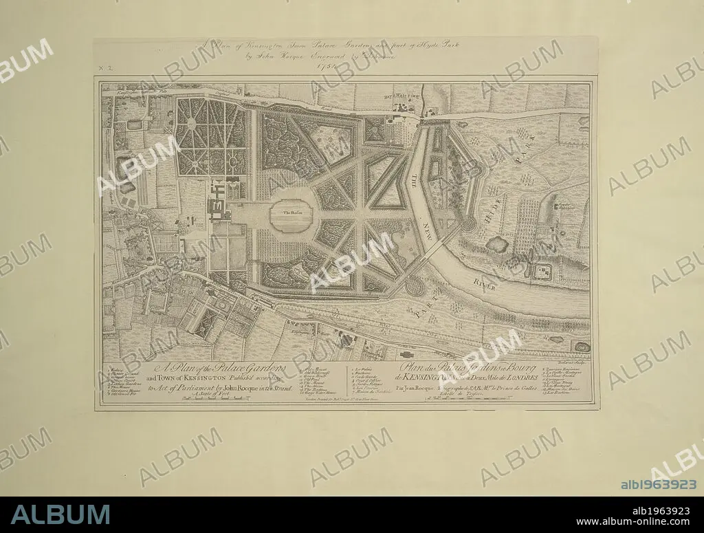
JOHN ROCQUE. A plan of Kensington Town Palace, Gardens and part of Hyde Park. 1754. Source: Maps.Crace.10.2. Language: English.
| Share |
|---|
 Pinterest Pinterest |
 Twitter Twitter |
 Facebook Facebook |
 Copy link Copy link |
 Email Email |
|
Add to another lightbox |
|
Add to another lightbox |


Buy this image.
Select the use:

Author:
Caption:
A plan of Kensington Town Palace, Gardens and part of Hyde Park. 1754. Source: Maps.Crace.10.2. Language: English.
Credit:
Album / British Library
Releases:
Model: No - Property: No
Rights questions?
Rights questions?
Image size:
5682 x 4006 px | 65.1 MB
Print size:
48.1 x 33.9 cm | 18.9 x 13.4 in (300 dpi)
Keywords:
CARTOGRAPHY • CASTLE • CITY OF LONDON • COMPLEX • COMPLEXES • ENGLAND'S • ENGLAND • FORTRESS • GARDEN • GREAT BRITAIN • GREEN SPACE • HISTORIC ROYAL PALACES PROPERTY • JOHN ROCQUE • LONDON • LONDON. • MAP MAKING • MAP • MAPS • OPEN SPACE • PALACE • PALACIO • PALAIS • PALAZZO • PARK • PARKS • PLAN (CARTOGRAPHY) • RECREATIONAL LAND • ROYAL PALACES • U. K. • UNITED KINGDOM • WESTERN EUROPE
