alb3548509
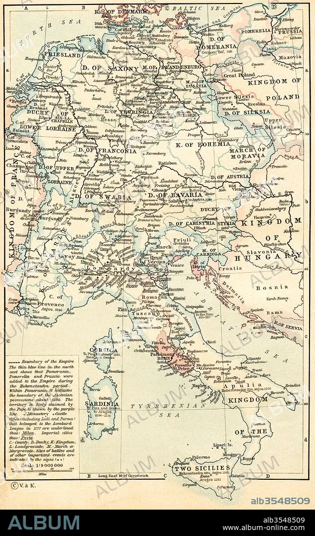
Map of The Holy Roman Empire under the Hohenstaufen, 1138-1254
| Share |
|---|
 Pinterest Pinterest |
 Twitter Twitter |
 Facebook Facebook |
 Copy link Copy link |
 Email Email |
|
Add to another lightbox |
|
Add to another lightbox |


Buy this image.
Select the use:

Title:
Map of The Holy Roman Empire under the Hohenstaufen, 1138-1254
Caption:
Map of The Holy Roman Empire under the Hohenstaufen, 1138 - 1254. From Historical Atlas, published 1923.
Credit:
Album / Universal Images Group / Universal History Archive
Releases:
Image size:
3509 x 5677 px | 57.0 MB
Print size:
29.7 x 48.1 cm | 11.7 x 18.9 in (300 dpi)
Keywords:
1138-1254 • 12 CENTURY • 12TH CENTURY • 12TH • 13TH CENTURY • 13TH • CENTURY • CHART • COUNTRIES • COUNTRY • DYNASTY • EMPIRE • GEOGRAFIA • GEOGRAPHICAL • GEOGRAPHY • GERMAN • GERMANS • HOHENSTAUFEN • HOLY • MAP • MAPS • PLAN (CARTOGRAPHY) • ROMAN • ROMANO • SACRED • SWABIAN • THIRTEENTH • TWELFTH • UNDER • XII CENTURY • XIII CENTURY
