alb5407564
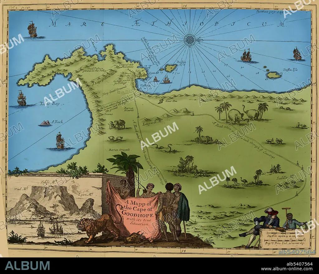
Africa, Cape of Good Hope Map,1744
| Share |
|---|
 Pinterest Pinterest |
 Twitter Twitter |
 Facebook Facebook |
 Copy link Copy link |
 Email Email |
|
Add to another lightbox |
|
Add to another lightbox |


Buy this image.
Select the use:

Title:
Africa, Cape of Good Hope Map,1744
Caption:
Map of the Cape of Good Hope, South Africa, published 1744 - 1746.
Credit:
Album / Science Source
Releases:
Model: No - Property: No
Rights questions?
Rights questions?
Image size:
3912 x 3148 px | 35.2 MB
Print size:
33.1 x 26.7 cm | 13.0 x 10.5 in (300 dpi)
Keywords:
1740S • 18TH CENTURY • 18TH CENTURY, THE • 18TH • AFRICA • AFRICAN CONTINENT • AFRICAN • CAPE OF GOOD HOPE • CARTOGRAPHY • COLONIALISM • ENGLISH • ENHANCED • HISTORY • MAP MAKING • MAP • SOUTH AFRICA • SOUTH AFRICAN • XVIII CENTURY
