alb5407169
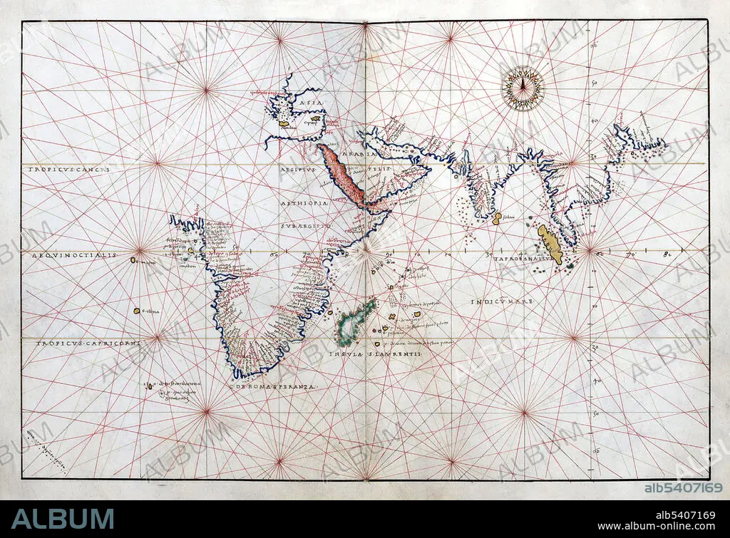
Battista Agnese, Portolan Atlas, Indian Ocean, 1544
| Share |
|---|
 Pinterest Pinterest |
 Twitter Twitter |
 Facebook Facebook |
 Copy link Copy link |
 Email Email |
|
Add to another lightbox |
|
Add to another lightbox |


Title:
Battista Agnese, Portolan Atlas, Indian Ocean, 1544
Caption:
Portolan atlas of 9 charts and a world map by Battista Agnese Dedicated to Hieronymus Ruffault, Abbot of St. Vaast, 1544. Battista Agnese (1500, 1564) was a cartographer from the Republic of Genoa, who worked in the Venetian Republic. His workshop produced at least 71 manuscript atlases of sea charts between 1534 and 1564, more cheaply than Dieppe maps but still considered of fine craftsmanship. The charts normally included latitude but not longitude, along with various decorative features.
Credit:
Album / LOC/Geography and Map Division/Science Source
Releases:
Model: No - Property: No
Rights questions?
Rights questions?
Image size:
4500 x 3084 px | 39.7 MB
Print size:
38.1 x 26.1 cm | 15.0 x 10.3 in (300 dpi)
Keywords:
1500S • 1544 • 16 16TH XVI XVITH SIXTEENTH CENTURY • 16 CENTURY • 16TH CENTURY • 16TH • AGE • ÂGÉS • AGNESE • ATLAS • BATTISTA • CARTOGRAPHIC • CARTOGRAPHICAL • CARTOGRAPHY • CELEBRITIES • CELEBRITY • CENTURY • CHART • DISCOVERY • EXPLORATION • FAMOUS • FLEET • GEOGRAPHIC • GEOGRAPHICAL • GEOGRAPHY • HISTORIC • HISTORICAL • HISTORY • IMPORTANT • INDIAN • INDIGENOUS PEOPLES OF THE AMERICAS • INDIO • INFLUENTIAL • MAKING • MAP MAKING • MAP • MAP-MAKING • MAPMAKING • MARINE • NAVIGATION • NAVIGATIONAL • NAVY • NOTABLE • OCEAN • OF • OLD • PORTOLAN • PORTOLANO • SEA • SEAS • SIXTEENTH • WELL-KNOWN
