alb4475004
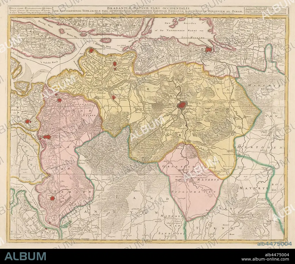
Map of the Baronie van Breda, Brabantiae Batavae pars occidentalis, sive Antverpiensis tetrarchiae pars septentrionalis: comprehendens Baroniam Bredanam, Marchionatum Bergensem ad Zomam (title on object), Map of the barony of Breda and immediate surroundings. Top left legend of cities and towns. Top right the scale in German and French miles, maps of separate countries or regions, Brabant, Breda, Nicolaes Visscher (I), Amsterdam, c. 1680 and/or c. 1780, paper, watercolor (paint), engraving, h 48.8 cm × w 57.9 cm.
| Share |
|---|
 Pinterest Pinterest |
 Twitter Twitter |
 Facebook Facebook |
 Copy link Copy link |
 Email Email |
|
Add to another lightbox |
|
Add to another lightbox |


Caption:
Map of the Baronie van Breda, Brabantiae Batavae pars occidentalis, sive Antverpiensis tetrarchiae pars septentrionalis: comprehendens Baroniam Bredanam, Marchionatum Bergensem ad Zomam (title on object), Map of the barony of Breda and immediate surroundings. Top left legend of cities and towns. Top right the scale in German and French miles, maps of separate countries or regions, Brabant, Breda, Nicolaes Visscher (I), Amsterdam, c. 1680 and/or c. 1780, paper, watercolor (paint), engraving, h 48.8 cm × w 57.9 cm
Credit:
Album / quintlox
Releases:
Model: No - Property: No
Rights questions?
Rights questions?
Image size:
5687 x 4805 px | 78.2 MB
Print size:
48.1 x 40.7 cm | 19.0 x 16.0 in (300 dpi)
Keywords:
1680 • 1780 • AMSTERDAM • BARONIE VAN BREDA • BARONY • BRABANT • BRABANTIAE BATAVAE PARS OCCIDENTALIS • BREDA • C • CITIES • CITY • COMPREHENDENS BARONIAM BREDANAM • ENGRAVED • ENGRAVING (ARTWORK) • ENGRAVING • ENGRAVING. • ENGRAVINGS • ETCHING • FRENCH MILES • GERMAN • GERMANS • I • IMMEDIATE SURROUNDINGS • MAP • MAPS • MARCHIONATUM BERGENSEM AD ZOMAM • NICOLAES VISSCHER • OBJECT • OBJECTS • PAINT • PAPER AND PACKAGE PRODUCTS • PAPER • PLAN (CARTOGRAPHY) • PRINT • REGIONS • SCALE • SEPARATE COUNTRIES • SIVE ANTVERPIENSIS TETRARCHIAE PARS SEPTENTRIONALIS • TITLE • TOP LEFT LEGEND • TOP RIGHT • TOWN • TOWNS • UMBRELLA • WATERCOLOR • WATERCOLOUR
