alb9203323
Water Stress by 2040, Map
| Share |
|---|
 Pinterest Pinterest |
 Twitter Twitter |
 Facebook Facebook |
 Copy link Copy link |
 Email Email |
|
Add to another lightbox |
|
Add to another lightbox |


Buy this image.
Select the use:

Title:
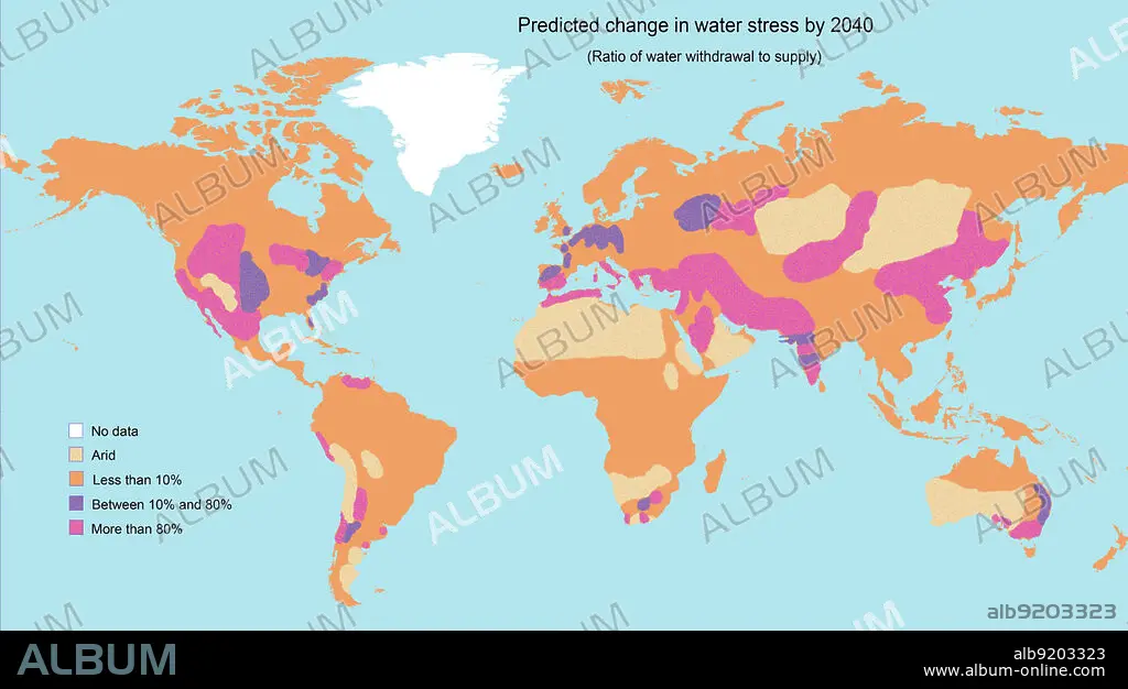
Water Stress by 2040, Map
Caption:
A map showing the predicted change in water stress (the ratio of water withdrawal to supply) by 2040. The areas of greatest stress are roughly indicated in bright purple. They include the western USA and Central America, southern Europe, the Middle East and parts of Asia, Northern Africa, South Africa, and parts of Australia and South America. Data adapted from the World Resources Institute.
Credit:
Album / Jessica Wilson / Science Source
Releases:
Model: No - Property: No
Rights questions?
Rights questions?
Image size:
Not available
Print size:
Not available
Keywords:
2040 • AREAS • ARID • BIOME • BIOMES • BOREAL • CHANGE • CLAIM • CLIMATE • COLD • DEMAND • DESERT • DIAGRAM • DIVISIONS • DROUGHT • EARTH • ECOLOGY • ECOSYSTEM • EDUCATION • ENVIRONMENT • FORECAST • FUTURE • GEOLOGIA • GEOLOGY • GLACE • GLOBAL • GLOBE • HUMID • ICE (WEATHER) • ICE • ICE, FROZEN LAKES&STREAMS • INFOGRAPHIC • INTERFROST • LABELED • MAJOR • MAP • MEDITERRANEAN • PERCENTAGE • PERMAFROST • PREDICITION • SEMI-ARID • SHORTAGE • SOIL • STRESS • SUPPLY • TEMPERATE • TROPICAL • TUNDRA • WARM • WARMING • WATER • WEATHER • WORLD • ZONES
