alb8361212
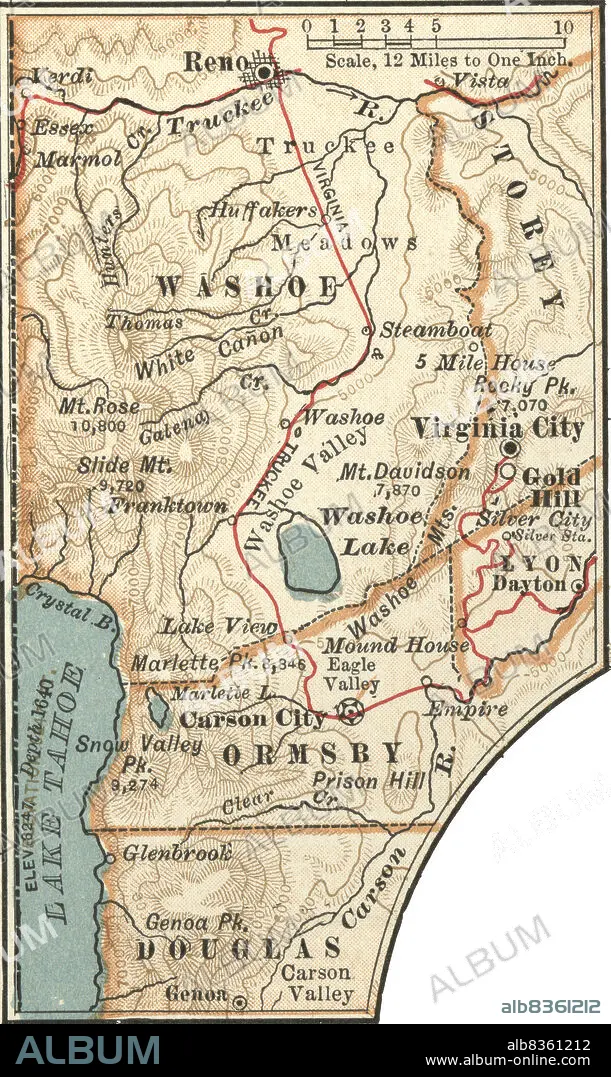
Map of Carson City with Virginia City and Reno
| Share |
|---|
 Pinterest Pinterest |
 Twitter Twitter |
 Facebook Facebook |
 Copy link Copy link |
 Email Email |
|
Add to another lightbox |
|
Add to another lightbox |


Buy this image.
Select the use:

Caption:
Map of Carson City with Virginia City and Reno
Credit:
Album / Universal Images Group / Encyclopaedia Britannica
Releases:
Image size:
2406 x 4034 px | 27.8 MB
Print size:
20.4 x 34.2 cm | 8.0 x 13.4 in (300 dpi)
Keywords:
10TH EDITION • 19 CENTURY • 1900 • 1900S • 1902 • 1990S • 19TH CENTURY • 19TH CENTURY. • 19TH • 19TH-CENTURY • 90S • AMERICA NORTH • BOUNDARIES • BOUNDARY • CARSON CITY • CARTOGRAPHY • CITIES • CITY • CIUDAD • DETAIL • DOUGLAS • EARLY 20TH CENTURY • EARLY TWENTIETH CENTURY • EEUU • EXPLORATION • FLOOR (BUILDING) • FRONTIER • GEOGRAFIA • GEOGRAPHICAL • GEOGRAPHY • GOLD HILL • HISTORIA UNIVERSAL • HISTORIA • HISTORICAL • HISTORY • HISTORY. • INSET • LAKE TAHOE • LEVEL (BUILDING) • LIMIT • LYON • MAP MAKING • MAP • MAPS • NEVADA • NINETEENTH CENTURY • NINETIES • NINETIES, THE • NINETY DECADE • NORTH AMERICA • NORTH AMERICAN • ORMSBY • PHYSICAL MAP • PLAN (CARTOGRAPHY) • RENO • STOREY • TENTH EDITION • TOWN • TOWNS • U S A • U. S. A • U. S. A. • UNITED STATES AMERICA • UNITED STATES OF AMERICA • UNITED STATES • USA • USA. UNITED STATES • VERTICAL LINES • VERTICAL • VICINITY • VIRGINIA CITY • WASHOE LAKE • WASHOE VALLEY • WASHOE • XIX CENTURY
