alb4088783
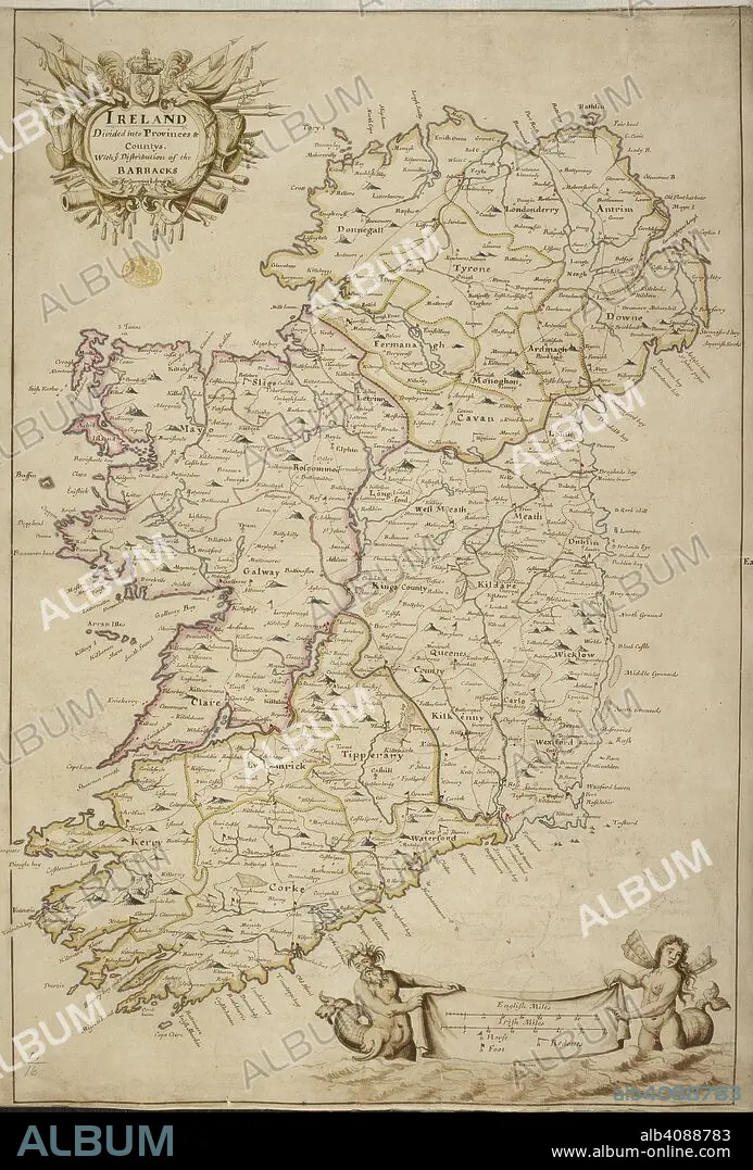
A map of Ireland divided into provinces and counties. A colored map of Ireland "divided into provinces and countys, with the distribution of the barracks for quartering the army". ca. 1700. Source: Maps K.Top.51.16. Language: English.
| Share |
|---|
 Pinterest Pinterest |
 Twitter Twitter |
 Facebook Facebook |
 Copy link Copy link |
 Email Email |
|
Add to another lightbox |
|
Add to another lightbox |


Buy this image.
Select the use:

Caption:
A map of Ireland divided into provinces and counties. A colored map of Ireland "divided into provinces and countys, with the distribution of the barracks for quartering the army". ca. 1700. Source: Maps K.Top.51.16. Language: English.
Credit:
Album / British Library
Releases:
Image size:
4518 x 6672 px | 86.2 MB
Print size:
38.3 x 56.5 cm | 15.1 x 22.2 in (300 dpi)
Keywords:
18TH CENTURY • 18TH CENTURY, THE • 18TH CENTURY. • 18TH • CARTE • CARTOGRAPHIC • CARTOGRAPHY • EIRE • IRELAND • MAP MAKING • MAP • MAPS • PLAN (CARTOGRAPHY) • REPUBLIC OF IRELAND • XVIII CENTURY
