alb5468017
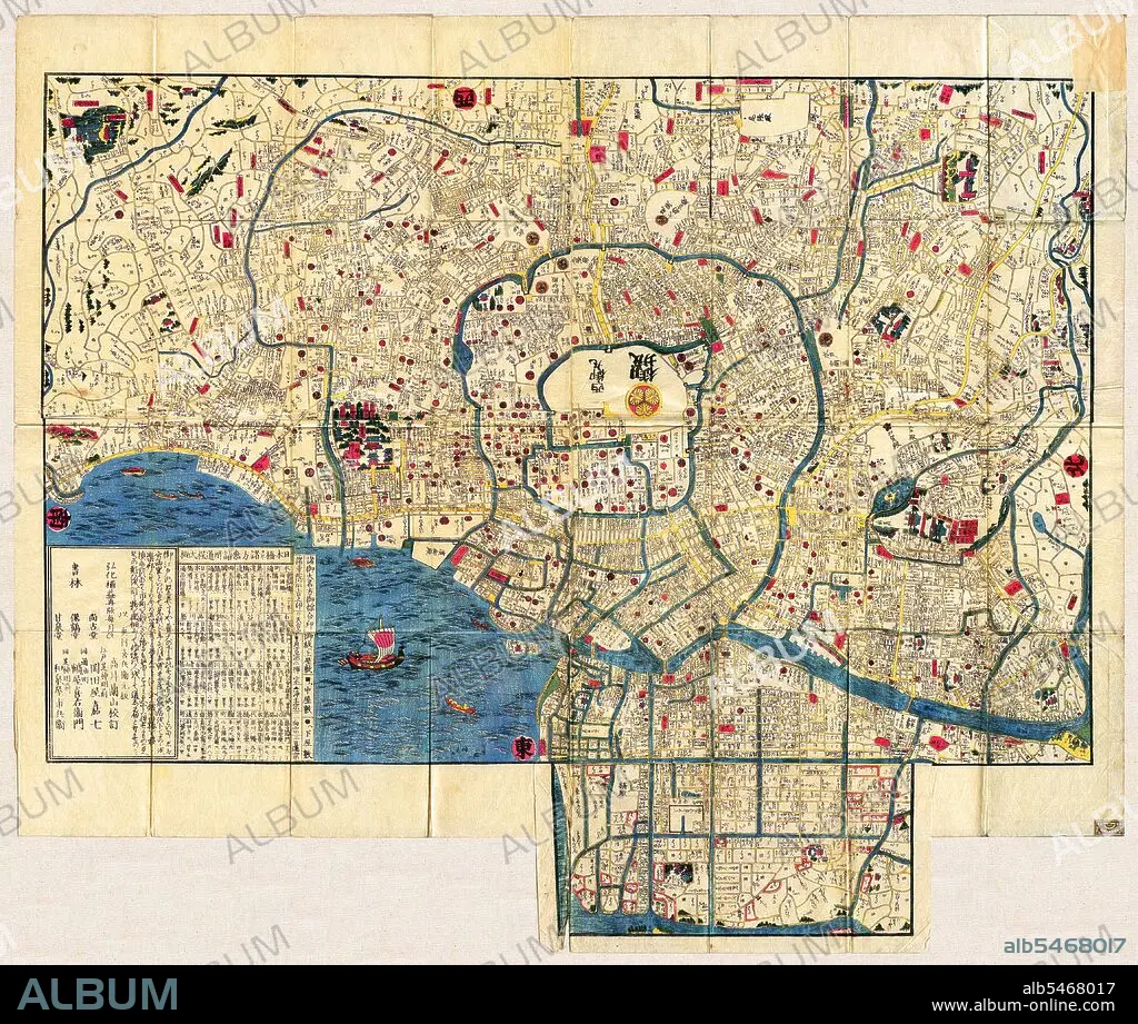
Japan: Map of Edo (now the city of Tokyo) c. 1844 (top is due west)
| Share |
|---|
 Pinterest Pinterest |
 Twitter Twitter |
 Facebook Facebook |
 Copy link Copy link |
 Email Email |
|
Add to another lightbox |
|
Add to another lightbox |


Buy this image.
Select the use:

Title:
Japan: Map of Edo (now the city of Tokyo) c. 1844 (top is due west)
Caption:
Edo (??, literally 'bay-entrance' or 'estuary'), also romanized as Yedo or Yeddo, is the former name of the Japanese capital Tokyo, and was the seat of power for the Tokugawa shogunate which ruled Japan from 1603 to 1868. During this period it grew to become one of the largest cities in the world and the site of a vibrant urban culture centered on notions of the 'floating world'. The northeastern corner of the city, regarded as a dangerous direction in traditional onmyodo (cosmology/geomancy), is guarded from evil spirits by a series of temples, including Senso-ji and Kan'ei-ji. Just beyond these lay the districts of the eta or outcastes, who engaged in unclean vocations and were thus separated from the main sections of commoner residences. A long dirt path extended west from the riverbank, a short distance north of these eta districts, leading along the northern edge of the city to the Yoshiwara pleasure districts. Previously located within the city proper, close to Asakusa, the districts were rebuilt in this more distant location after the Meireki Fire of 1657.
Credit:
Album / Pictures From History/Universal Images Group
Releases:
Image size:
4600 x 3900 px | 51.3 MB
Print size:
38.9 x 33.0 cm | 15.3 x 13.0 in (300 dpi)
Keywords:
ASIA PICTURES • ASIA • ASIAN IMAGE • ASIAN IMAGES • ASIAN PICTURES • ASIAN • CARTOGRAPHY • CHART • EDO • HISTORIA UNIVERSAL • HISTORIA • HISTORICAL IMAGES • HISTORICAL PICTURES • HISTORICAL • HISTORY IMAGES • HISTORY PICTURES • HISTORY • HISTORY. • JAPAN • JAPANESE • MAP MAKING • MAP • MAPS • PLAN (CARTOGRAPHY) • TOKYO • YOSHIWARA
