alb4958020
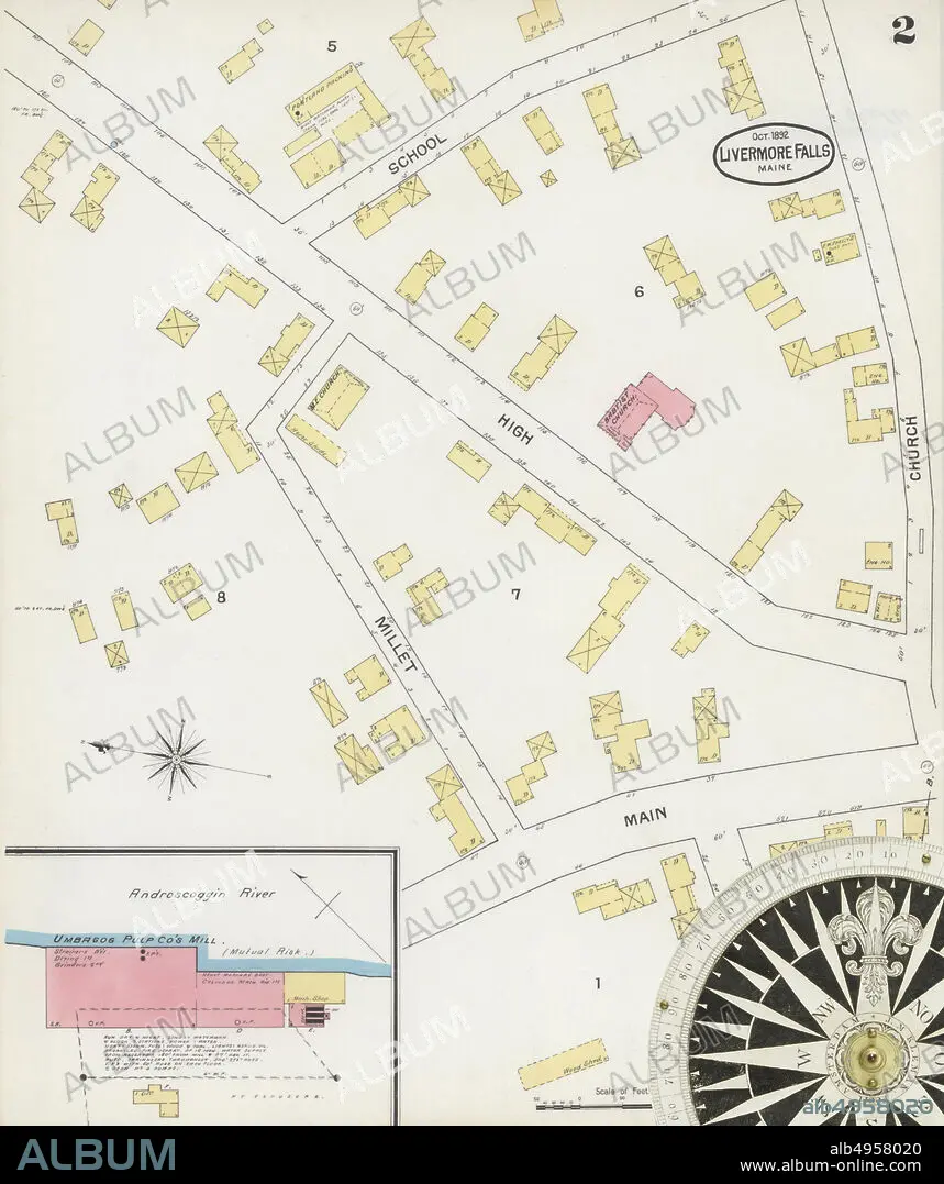
Image 2 of Sanborn Fire Insurance Map from Livermore Falls, Androscoggin County, Maine. Oct 1892. 2 Sheet(s), America, street map with a Nineteenth Century compass.
| Share |
|---|
 Pinterest Pinterest |
 Twitter Twitter |
 Facebook Facebook |
 Copy link Copy link |
 Email Email |
|
Add to another lightbox |
|
Add to another lightbox |


Buy this image.
Select the use:

Caption:
Image 2 of Sanborn Fire Insurance Map from Livermore Falls, Androscoggin County, Maine. Oct 1892. 2 Sheet(s), America, street map with a Nineteenth Century compass
Credit:
Album / quintlox
Releases:
Image size:
5000 x 5960 px | 85.3 MB
Print size:
42.3 x 50.5 cm | 16.7 x 19.9 in (300 dpi)
Keywords:
2 SHEET (S) • AMERICA • AMERICA. • AMERICAS • AMERICAS, THE • ANDROSCOGGIN COUNTY • ATLAS • CARTOGRAPHY • CITIES • CITY • CIUDAD • EEUU • GEOGRAFIA • GEOGRAPHY • IMAGE 2 • JOURNEY • JOURNEYMAN'S TRAVEL • JOURNEYMAN'S TRAVELS • LANDMARK • LEISURE • LIVERMORE FALLS • MAINE • MAP MAKING • NINETEENTH CENTURY COMPASS • OCT 1892 • OLD • OUTDOOR • OUTDOORS • OUTSIDE • ROAD • ROADS • RUA • SANBORN FIRE INSURANCE MAP • STREET MAP • STREET • STREETS • THRIP • TOWN • TOWNS • TRAVEL • TRAVELING • TRAVELS • TRIP • TRIPS • U. S. A • U. S. A. • UNITED STATES AMERICA • UNITED STATES OF AMERICA • UNITED STATES • URBAN • USA • USA. UNITED STATES • VIA • VINTAGE • VOYAGE • WAY
