alb3120066
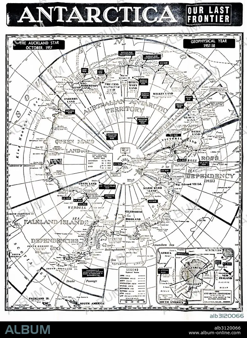
Antarctica map showing the various national zones.
| Share |
|---|
 Pinterest Pinterest |
 Twitter Twitter |
 Facebook Facebook |
 Copy link Copy link |
 Email Email |
|
Add to another lightbox |
|
Add to another lightbox |


Buy this image.
Select the use:

Title:
Antarctica map showing the various national zones.
Caption:
Antarctica map showing the various national zones or bases for countries including the UK; France; USA; Russia, 1958.
Credit:
Album / Universal Images Group / Universal History Archive
Releases:
Image size:
4016 x 5222 px | 60.0 MB
Print size:
34.0 x 44.2 cm | 13.4 x 17.4 in (300 dpi)
Keywords:
1950 • 1950S • 20 20TH XX XXTH TWENTIETH CENTURY • 20 XX TWENTIETH CENTURY • 20TH CENTURY • 20TH • ANTARCTIC • ANTARCTICA • BASES • CARTOGRAPHY • EEUU • FRANCE • FRANCE. • IMPERIALISM • LA FRANCE • MAP MAKING • MAP • MAPS • NATIONAL • PLAN (CARTOGRAPHY) • POLAR • RIVALRIES • RIVALRY • RUSIA • RUSSIA • TERRITORY • TWENTIETH CENTURY • U S A • U. S. A • U. S. A. • UK • UNITED STATES AMERICA • UNITED STATES OF AMERICA • UNITED STATES • USA • USA. UNITED STATES • ZONES
