alb10640358
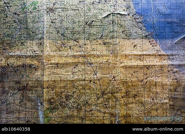
Utah Beach Ordnance Survey map annotated by general Raymond Barton during the D-Day invasion in Normandy, France, Europe.
| Share |
|---|
 Pinterest Pinterest |
 Twitter Twitter |
 Facebook Facebook |
 Copy link Copy link |
 Email Email |
|
Add to another lightbox |
|
Add to another lightbox |


Caption:
Utah Beach Ordnance Survey map annotated by general Raymond Barton during the D-Day invasion in Normandy, France, Europe
Credit:
Album / ImageBroker / alimdi / Arterra / Philippe Clément
Releases:
Model: No - Property: No
Rights questions?
Rights questions?
Image size:
600 x 400 px | 703.1 KB
Print size:
5.1 x 3.4 cm | 2.0 x 1.3 in (300 dpi)
Keywords:
1939-1945 • BEACH • BEACHES • BEACHFRONT • COAST • COASTS • D-DAY • DESERTED • EMPTY • FRANCE • GENERAL • GENERALS • HISTORIC • HISTORICAL • HISTORY • INVASION OF NORMANDY BY THE ALLIES • MAP • MAPS • MILITARY • NAVIGATION • NO ONE • NO PEOPLE • NO-ONE • NOBODY • NORMANDY • ORIENTATION • SECOND WORLD WAR • SHORE • UNINHABITED • UTAH BEACH • WESTERN EUROPE • WITHOUT PEOPLE • WORLD WAR 2 • WORLD WAR II • WORLD WAR TWO • WORLD WAR • WORLD WARS • WW 2 • WW II • WW2 • WWII
