alb3547759
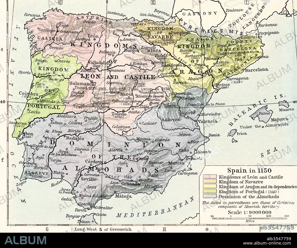
Map of Spain in 1150, showing the kingdoms of León and Castile, kingdom of Navarre, kingdoms of Aragon and its dependencies, kingdom of Portugal in 1140 and Dominion of the Almohads
| Share |
|---|
 Pinterest Pinterest |
 Twitter Twitter |
 Facebook Facebook |
 Copy link Copy link |
 Email Email |
|
Add to another lightbox |
|
Add to another lightbox |


Buy this image.
Select the use:

Title:
Map of Spain in 1150, showing the kingdoms of León and Castile, kingdom of Navarre, kingdoms of Aragon and its dependencies, kingdom of Portugal in 1140 and Dominion of the Almohads
Caption:
Map of Spain in 1150, showing the kingdoms of León and Castile, kingdom of Navarre, kingdoms of Aragon and its dependencies, kingdom of Portugal in 1140 and Dominion of the Almohads. From Historical Atlas, published 1923.
Credit:
Album / Universal Images Group / Universal History Archive
Releases:
Model: No - Property: No
Rights questions?
Rights questions?
Image size:
4898 x 3849 px | 53.9 MB
Print size:
41.5 x 32.6 cm | 16.3 x 12.8 in (300 dpi)
Keywords:
1140 • 1150 • 12 CENTURY • 12TH CENTURY • 12TH • ALMOHADS • ARAGON • CASTILE • CENTURY • CHART • COUNTRIES • COUNTRY • DEPENDENCIES • DOMINION • ESPANA • GEOGRAFIA • GEOGRAPHICAL • GEOGRAPHY • HISTORIA UNIVERSAL • HISTORIA • HISTORICAL • HISTORY • HISTORY. • KINGDOM • KINGDOMS • LEON • MAP • MAPS • NAVARRE • PLAN (CARTOGRAPHY) • PORTUGAL • SPAIN • SPANISH • TWELFTH • XII CENTURY
