alb3387542
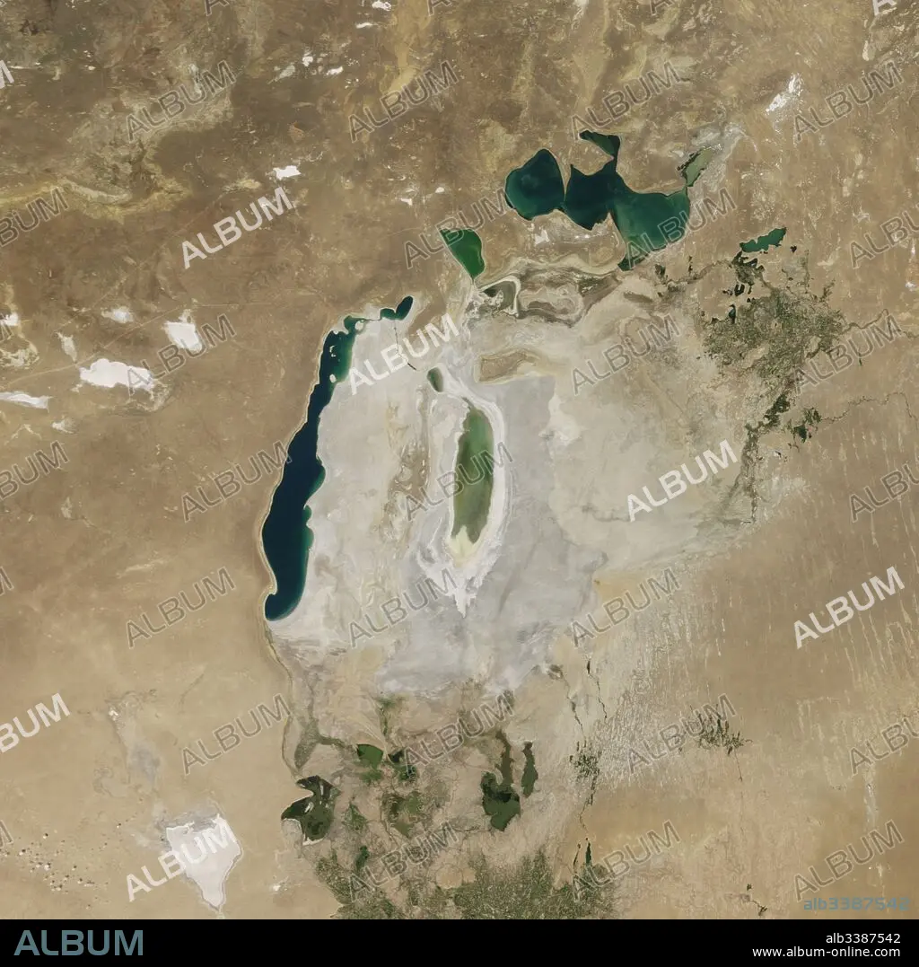
Satellite image of the shrinking of the Aral Sea taken in 2016.
| Share |
|---|
 Pinterest Pinterest |
 Twitter Twitter |
 Facebook Facebook |
 Copy link Copy link |
 Email Email |
|
Add to another lightbox |
|
Add to another lightbox |


Buy this image.
Select the use:

Title:
Satellite image of the shrinking of the Aral Sea taken in 2016.
Caption:
Satellite image of the shrinking of the Aral Sea taken in 2016. The Aral Sea, is a lake lying between Kazakhstan, in the north and Uzbekistan in the south. The name roughly translates as 'Sea of Islands', referring to over 1,100 islands that once dotted its waters; Formerly one of the four largest lakes in the world with an area of 68,000 km2 (26,300 sq mi), the Aral Sea has been steadily shrinking since the 1960s after the rivers that fed it were diverted by Soviet irrigation projects.
Credit:
Album / Universal Images Group / Universal History Archive
Releases:
Model: No - Property: No
Rights questions?
Rights questions?
Image size:
4579 x 4579 px | 60.0 MB
Print size:
38.8 x 38.8 cm | 15.3 x 15.3 in (300 dpi)
Keywords:
ARAL SEA • ARAL • DESERTIFICATION • DIVERTED • EARTH FROM SPACE • ENVIRONMENT • FLEET • IRRIGATION • KAZAKHSTAN • LACUNA • LAKE • LAKES • MARINE • NAVY • OCEAN • OCEANS • POND • PROJECT • RIO • RIVER • RIVERS • SATELLITE IMAGE • SATELLITE • SEA • SEA. • SEAS • SHRINKING • SOVIET • UZBEKISTAN • WATER
