alb8372672
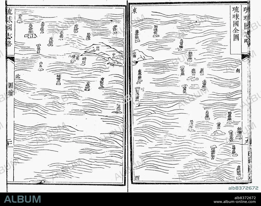
Japan / China / Ryukyu Islands: Liu Qiu Guo quan tu< / i> ('A Map of the Country of Liqu Qiu'), late Ming or early Qing Dynasty map, c. late 17th century
| Share |
|---|
 Pinterest Pinterest |
 Twitter Twitter |
 Facebook Facebook |
 Copy link Copy link |
 Email Email |
|
Add to another lightbox |
|
Add to another lightbox |


Buy this image.
Select the use:

Title: Japan / China / Ryukyu Islands: Liu Qiu Guo quan tu< / i> ('A Map of the Country of Liqu Qiu'), late Ming or early Qing Dynasty map, c. late 17th century
Caption: The Ryukyu Kingdom (historical English name: Lewchew, Luchu, or Loochoo) was an independent kingdom that ruled most of the Ryukyu Islands from the 15th to the 19th century. The kings of Ryukyu unified Okinawa Island and extended the kingdom to the Amami Islands in modern-day Kagoshima Prefecture, and the Sakishima Islands near Taiwan.
. Despite its small size, the kingdom played a central role in the maritime trade networks of medieval East and Southeast Asia.
. Despite its small size, the kingdom played a central role in the maritime trade networks of medieval East and Southeast Asia.
Credit: Album / Universal Images Group / Pictures From History
Releases: ? Model Release: No - ? Property Release: No
Rights questions?
Rights questions?
Image size: 5100 × 3758 px | 54.8 MB
Print size: 43.2 × 31.8 cm | 2007.9 × 1479.5 in (300 dpi)
Keywords: 17TH CENTURY • 17TH CENTURY. • 17TH • 17TH-CENTURY • ASIA • ASIAN • CARTOGRAPHY • CHART • CHINA • CHINE • CHINESE • DYNASTY: MING • JAPAN • JAPANESE • LIQU QIU • MAP MAKING • MAP • MAPS • MING DYNASTY • MING • OKINAWA • PLAN (CARTOGRAPHY) • PORCELAIN • QING DYNASTY • QING • RYUKYU ISLANDS • RYUKYU KINGDOM • RYUKYU • RYUKYUAN • XVII CENTURY
