alb2595346
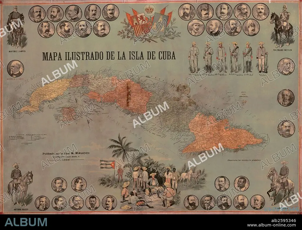
Mapa ilustrado de la isla de Cuba de 1896 con mandos y ejército español, e insurrectos cubanos.
| Share |
|---|
 Pinterest Pinterest |
 Twitter Twitter |
 Facebook Facebook |
 Copy link Copy link |
 Email Email |
|
Add to another lightbox |
|
Add to another lightbox |


Buy this image.
Select the use:

Caption:
Automatic translation: Illustrated map of the island of Cuba from 1896 with Spanish commanders and army, and Cuban insurgents
Mapa ilustrado de la isla de Cuba de 1896 con mandos y ejército español, e insurrectos cubanos.
Credit: Album / Documenta
Releases: ? Model Release: No - ? Property Release: No
Rights questions?
Rights questions?
Image size: 5500 × 3898 px | 61.3 MB
Print size: 46.6 × 33.0 cm | 2165.4 × 1534.6 in (300 dpi)
Keywords: 19 CENTURY • 19TH CENTURY • 19TH CENTURY. • 19TH • 19TH-CENTURY • ARMIES ARMY • ARMIES • ARMY'S • ARMY • CUBA • ESPANA • INSURGENT • ISLA • ISLAND • ISLANDS • MAP • MAPS • MILITAR • MILITARS • MILITARY • NINETEENTH CENTURY • PLAN (CARTOGRAPHY) • REBEL • SPAIN • XIX CENTURY
