alb2262759
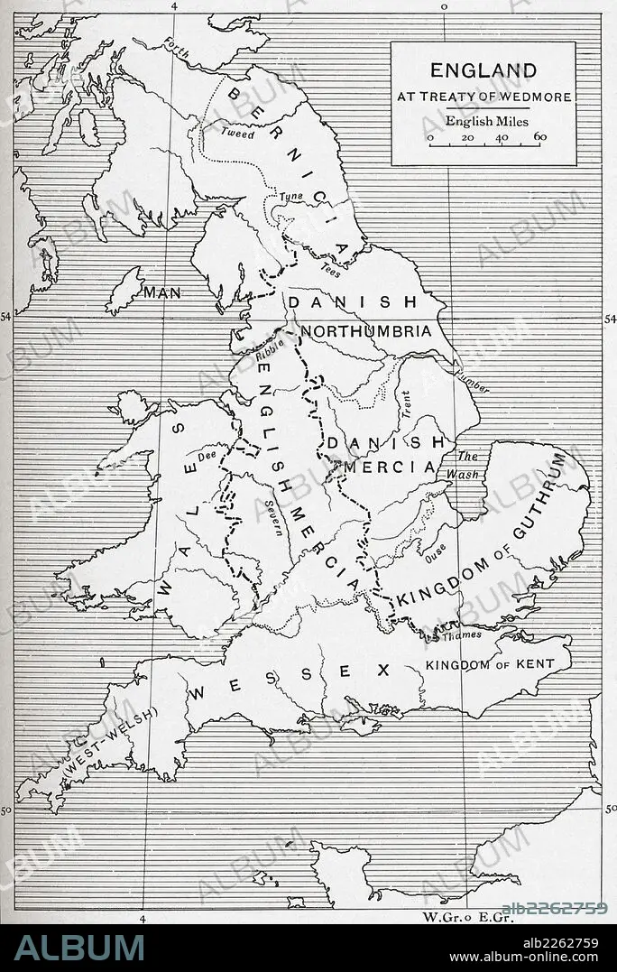
Map Of England At The Time Of The Treaty Of Wedmore In 878.
| Share |
|---|
 Pinterest Pinterest |
 Twitter Twitter |
 Facebook Facebook |
 Copy link Copy link |
 Email Email |
|
Add to another lightbox |
|
Add to another lightbox |


Buy this image.
Select the use:

Caption:
Map Of England At The Time Of The Treaty Of Wedmore In 878
Credit:
Album / Universal Images Group / Universal History Archive
Releases:
Model: No - Property: No
Rights questions?
Rights questions?
Image size:
3602 x 5394 px | 55.6 MB
Print size:
30.5 x 45.7 cm | 12.0 x 18.0 in (300 dpi)
Keywords:
9TH CENTURY • 9TH • BERNICIA • BRITAIN • BRITISH • CENTURY • DANISH • ENGLAND'S • ENGLAND • ENGLISH • GREAT BRITAIN • GREAT-BRITAIN • GUTHRIM • INGLES • KINGDOM • MAP • MAPS • MERCIA • NORTHUMBRIA • PLAN (CARTOGRAPHY) • TREATY • U. K. • UNITED KINGDOM • WEDMORE • WESSEX
