alb3546931
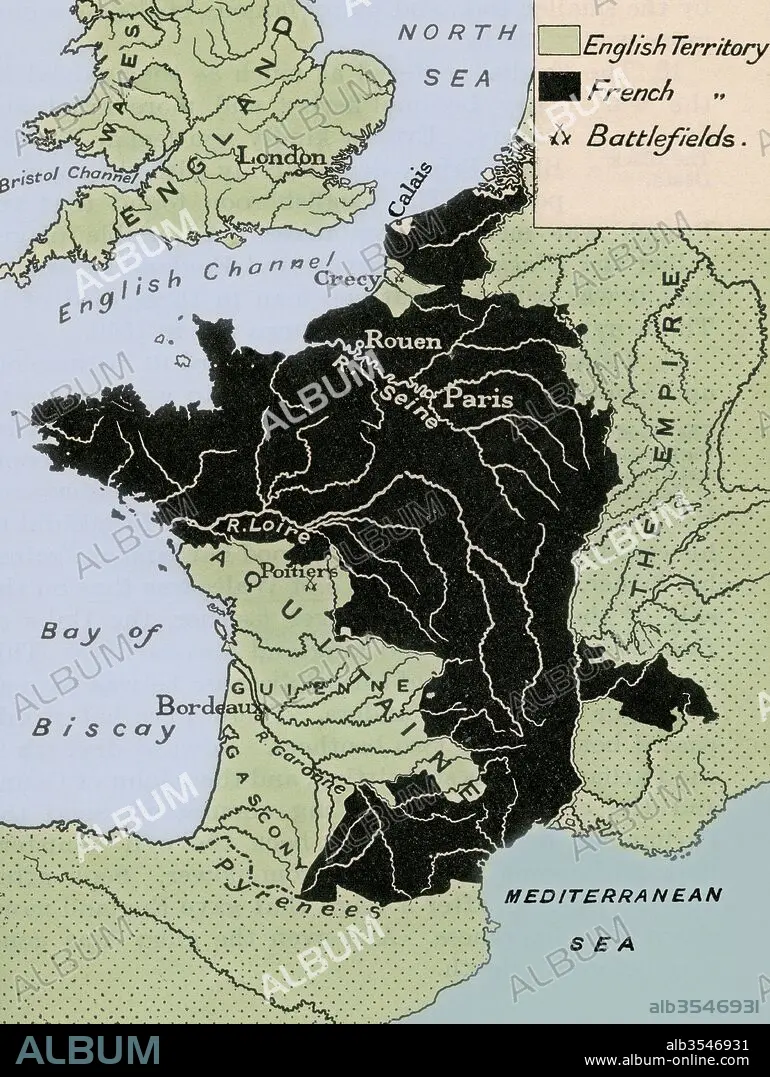
Map showing the English dominions in France after the Treaty of Calais in 1360
| Share |
|---|
 Pinterest Pinterest |
 Twitter Twitter |
 Facebook Facebook |
 Copy link Copy link |
 Email Email |
|
Add to another lightbox |
|
Add to another lightbox |


Buy this image.
Select the use:

Title: Map showing the English dominions in France after the Treaty of Calais in 1360
Caption: Map showing the English dominions in France after the Treaty of Calais in 1360. From A First Book of British History published 1925.
Credit: Album / Universal Images Group / Universal History Archive
Releases: ? Model Release: No - ? Property Release: No
Rights questions?
Rights questions?
Image size: 3707 × 4930 px | 52.3 MB
Print size: 31.4 × 41.7 cm | 1459.4 × 1940.9 in (300 dpi)
Keywords: 1360 • 14TH CENTURY • 14TH • 14TH-CENTURY • ÂGÉS • BRETIGNY • BRITISH • CALAIS • CENTURY • COUNTRIES • COUNTRY • DOMINIONS • ENGLISH • FOURTEENTH CENTURY • FOURTEENTH • FRANCE • FRANCE. • GEOGRAFIA • GEOGRAPHY • HISTORIA UNIVERSAL • HISTORIA • HISTORICAL • HISTORY • HISTORY. • INGLES • LA FRANCE • MAP • MAPS • MEDIAEVAL • MEDIEVAL • MIDDLE AGES • MIDDLE • PLAN (CARTOGRAPHY) • TREATY • XIV CENTURY
