alb2195065
Brooklyn Street Map-1874 1874
| Share |
|---|
 Pinterest Pinterest |
 Twitter Twitter |
 Facebook Facebook |
 Copy link Copy link |
 Email Email |
|
Add to another lightbox |
|
Add to another lightbox |


Title:
Brooklyn Street Map-1874 1874
Caption:
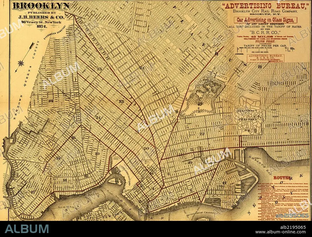
Street map of Brooklyn published for Advertising Bureau, Brooklyn City Rail Road Company. Overprinted in brown to show "Twelve Routes, 42 miles of Streets and Avenues Traversed by Cars, all Starting from Fulton Ferry." Contains a list of routes in lower left of map.
Credit:
Album / Universal Images Group / Universal History Archive/UIG
Releases:
Model: No - Property: No
Rights questions?
Rights questions?
Image size:
7210 x 5122 px | 105.7 MB
Print size:
61.0 x 43.4 cm | 24.0 x 17.1 in (300 dpi)
Keywords:
1874 • BOSTON • CARTOGRAPHIC • CARTOGRAPHY • HOOSAC • MAP MAKING • MAP • MAPS • MASSACHUSETTS • PLAN (CARTOGRAPHY) • RAIL • RAILROAD • RAILS • RAILWAY • ROUTES • TRAIN • TRAINS • TRANSPORTATION • TUNEL • TUNNEL
